The Sonoran Desert is an immersive setting for vehicle-based and overland-style adventure
Harsh light covered the landscape of sandstone canyons, rock formations and sand. In the Yuha Desert, on a trailhead just off Highway 98, the adventure began. As I arrived in this small portion of the Sonoran Desert in the Imperial Valley, I got out of the Jeep and was greeted by a desolate and inhospitable land. Before venturing into the desert, I did a visual check of the Jeep and aired down the tires for a better ride and traction.
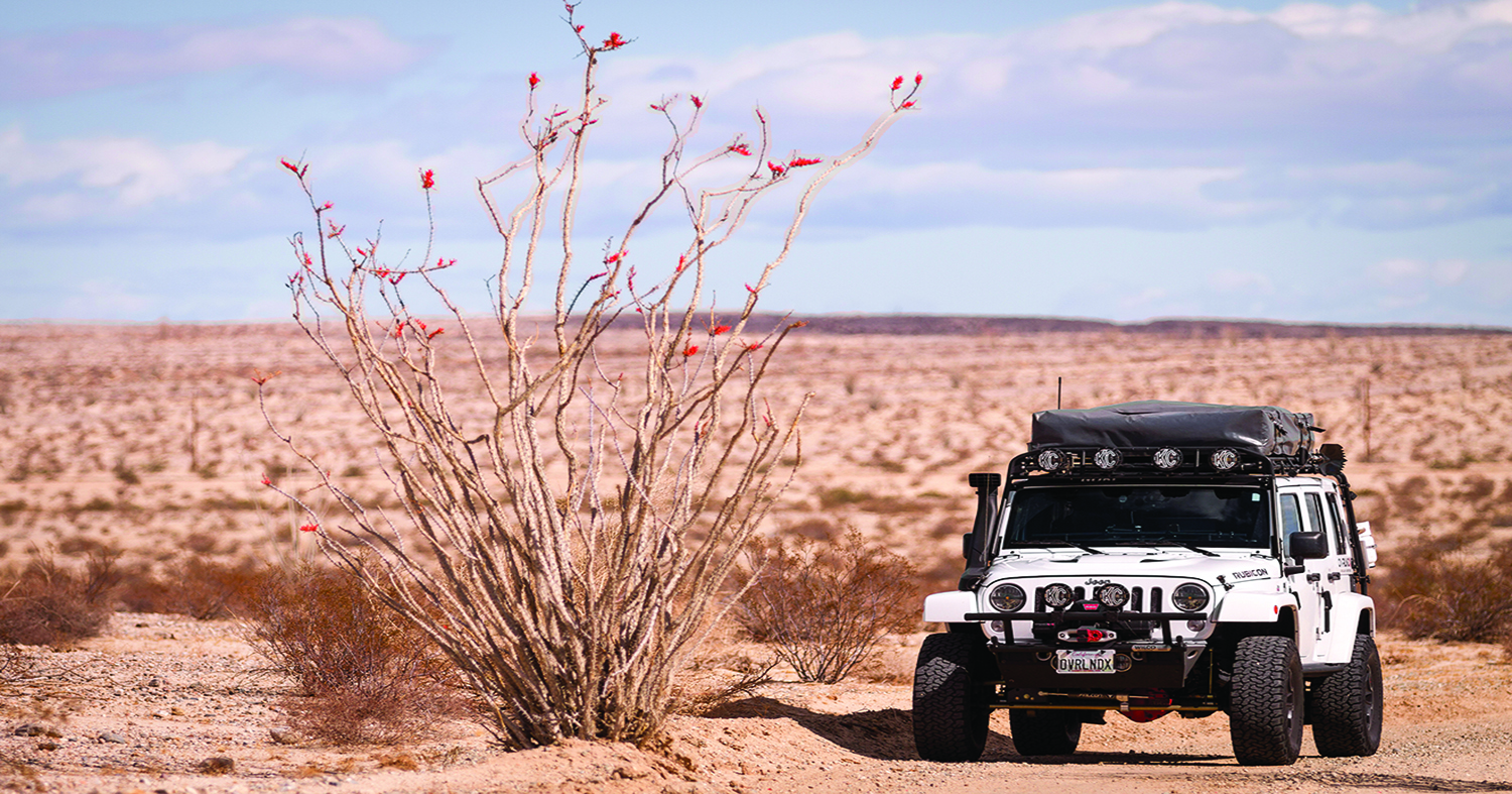
There are over 4,000 different species in the Sonoran desert. One of the most breathtaking plants I have ever seen resides here. The Ocotillo, which is indigenous to the southwestern United States and northern Mexico, can grow to a towering 30 feet. The large, spiny-stemmed plant is most beautiful after a rain, when crimson flowers appear.
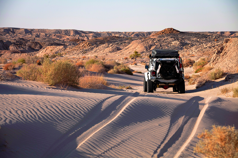
Driving through the Yuha Badlands
A quick glimpse to the south revealed the Jacumba Mountains, and on the horizon the Rumorosa Mountains, which sit on the Mexican side of the border. A sandy trail took me into the heart of the Yuha Desert Badlands.
Even before buying the Jeep, my wife, Georgina, and I have loved exploring the great outdoors. We have mountain biked and hiked in Africa, Europe, Mexico, and South America. My passions are photography and adventure travel, making my Jeep and my cameras my most important gear. And, since we reside in San Diego, California, the Anza desert is a frequent adventure destination. This time, it was a four-day camping trip to discover new camping spots and visit the amazing historic points in the area.
Juan Bautista de Anza
Juan Bautista de Anza was a Spanish explorer who volunteered to open the overland route from Mexico to California. The Spanish commander led almost 300 colonists on the expedition from Mexico to find a safer overland route to Alta California for the Spaniards. A Spanish outpost was needed because the dangerous sea routes were filled with Russian and English explorers wanting to colonize the area. Under the promise of finding new opportunities, a diverse mix of people of Native, European and Afro-Latino ancestry put their trust in Anza and became part of the expedition. The settlers, their military escorts and 1,000 head of livestock traveled for five and half months until they reached their destination: the area that is now San Francisco. There, they settled and established their outpost. Today, the Juan Bautista de Anza National Historic Trail, over 1,200 miles long, can be traveled by car. One is able to visit existing presidios, missions, and towns; many of these sites are listed in the National Register of Historic Places.
On my way to camp, through the town of Ocotillo via the Yuha Basin, I reached the bottom of a short hill and noticed the ground was covered with varied sand formations. They were crystallized in amazing geometric shapes of innumerable sizes in huge areas of ancient clay beds. As I drove through the sandstone canyons, the designated trail led me into the alluring landscape toward the Oyster Shell Beds. The never ending sandy wash surface was a constant performance test on the Jeep’s tires and suspension. To the west you can find the Yuha Well, one of the most important watering spots for Anza’s colonizing expedition. To the northwest are the Yuha Geoglyphs and the Anza Overlook monument which oversees the badlands.
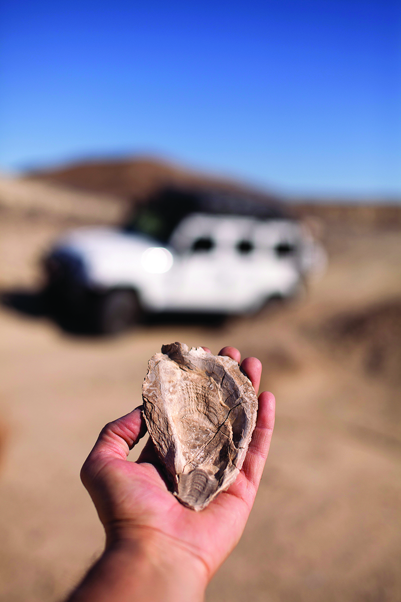
Desert fossilized mollusk
Driving through the Yuha Basin on a flat, sandy trail, I stopped to say hello to a Border Patrol officer who was patrolling the area. Because of the proximity to the southern border, it is common to see law enforcement activity in the area. I proceeded in my search for the famous Shell Beds. Once I hit the intersection of the Yuha Wash, I noticed a drastic change in the terrain and landscape. There were taller plants and trees, and larger mountains along the wash. In the distance, there was a path that came between two mountains and disappeared in the rugged landscape. At the end of that path were the Shell Beds. The ground was covered with oyster shell fossils and mounds of different mollusks, remnants of an ancient lake that covered most of the area years ago. I grabbed my camera and started exploring this surreal terrain, searching for the perfect fossil specimen. I found several and, following Tread Lightly! and Leave No Trace principles, I left the area as I found it without taking fossils with me.
After finding the Shell Beds, my next destination was the Yuha Well, which was named Santa Rosa de las Lajas by the Spanish scouts. It was once one of the most important sources of water between Yuma, Arizona and San Diego. Today, the well is covered; however, there are still remnants of when it was used by natives long ago.
On my way to the well, I had the chance to put the Jeep’s performance to the test on an open, fast and fun wash. I admired the vast terrain of the Yuha basin and noticed the numerous trails open for future adventures. I stopped for a quick lunch before exploring the area. Temperatures in the lower 100s made me decide to look around more quickly than usual, walk to the well, take a couple of photos and then jump in the Jeep. From there I headed toward the Anza Overlook and the Yuha Geoglyph.
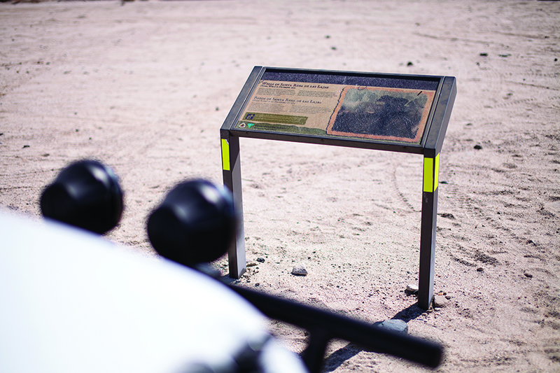
BLM’s Yuha well sign
West of the Yuha Well, inside a canyon of sandstone, I drove on a system of trails and sandy washes. I realized the terrain had gotten a bit more technical, though not extreme, which made vehicle exploration more exciting. After a couple of miles, the trail opened up to reveal the top of the Anza Overlook. From here, I was able to see the whole Yuha Basin all the way to the city of Calexico, California. The Anza Overlook Marker is one of many historical markers erected from Arizona to California to commemorate the Spanish Overland Expedition. Here, one can read the story of the event. Not far from the area is the Yuha Geoglyph, one of the most elaborate ground figures in the southwest made by aboriginal Native Americans. Unfortunately, because of vandalism, these ground drawings had to be reconstructed and are fenced and protected.
After visiting these amazing spots, it was time to head out and set up camp in the Canyon Sin Nombre, located just off Highway S2. I drove the last stretch of dirt trail down to the northern part of Highway 98 and, after airing up, I took the highway to camp. I crossed through the town of Ocotillo and admired, through my side mirrors, the beautiful sunset typical of the desert, along with the majestic wind towers that produce energy for San Diego and the Imperial Valley. I stopped for a few minutes to shoot a few photos of the amazing sight and then I headed toward Canyon Sin Nombre. Before losing signal, I sent my location to my good friend, Eric Dalcin, so he could catch up the following day. Eric is a passionate overlander from San Diego.
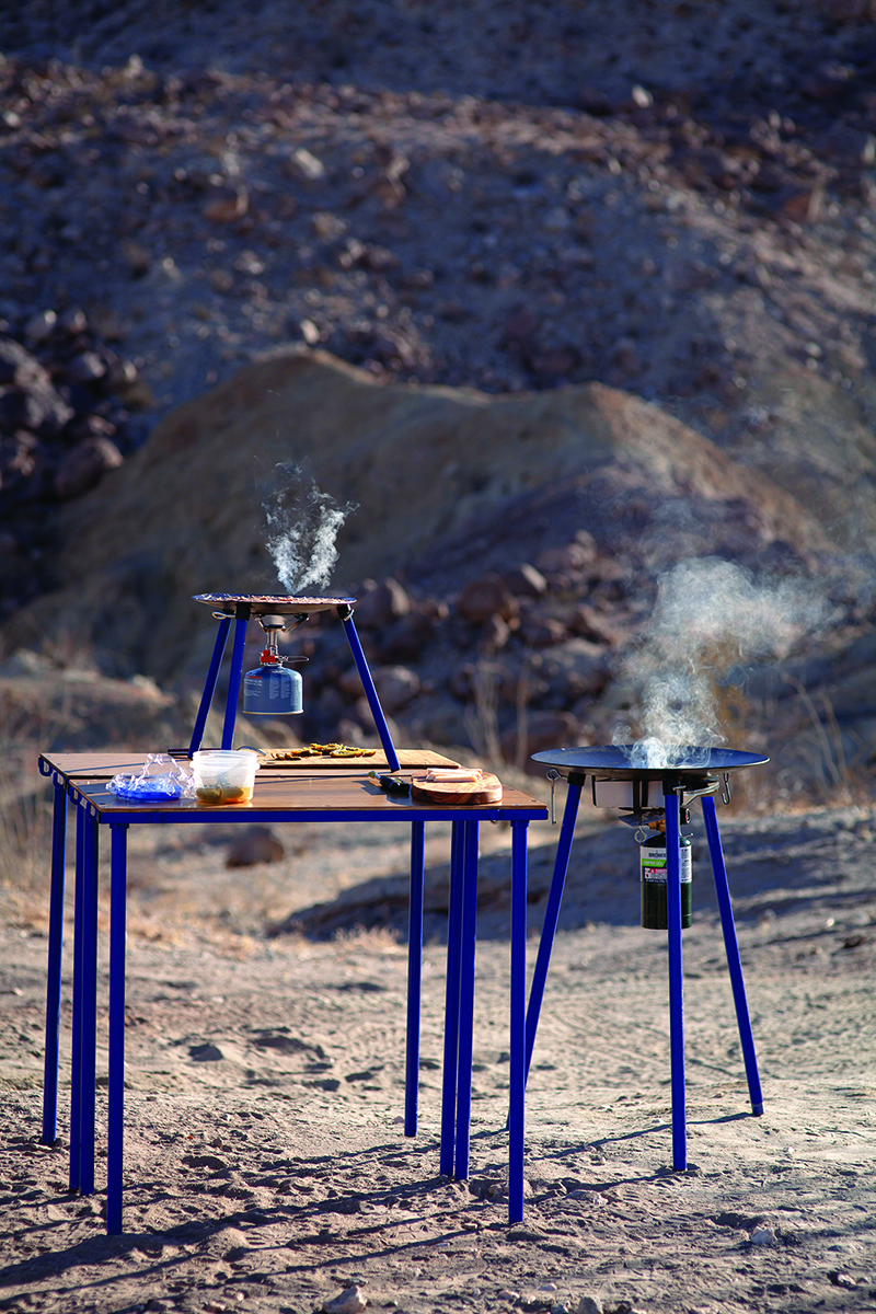
By the time I arrived at the canyon’s trailhead in the Carrizo Badlands, it was already dark. I drove just a couple miles and stopped to pitch camp. Under a beautiful full moon, I made that spot home for the night. After setting up and starting a bonfire, it was time for dinner. While I was enjoying grilled Ahi Tuna and Japanese-style fried rice, I noticed the full moon illuminating the tall sandstone and mudstone walls behind camp. I shot some photos of the sight and called it a night.
After a refreshing rest, which I’ve experienced that sleeping in the desert brings, I headed to the Arroyo Tapiado Mud Caves, one of the largest mud cave systems in the world. This area is one of the highlights of the Anza Borrego Park. With over 20 open caves, this place would take a whole day to explore. I ventured into two of the caves and was impressed by the drastic temperature drop as I stepped inside. After walking a few yards inside the second cave, I decided to come back out to look for Eric, who had planned to meet me at that spot. It wasn’t long before I saw his Jeep heading my way. We decided to head out to the Sandstone Canyon and find a good lunch spot in the area. Afterward, we took the sandy Arroyo Seco del Diablo Trail to our destination, which is about 16 miles from the caves. Along the way, there are several technical obstacles, including the famous Diablo Drop-off which takes you to the Fish Creek Trail, a route that has spectacular scenery and connections to several trails similar to the Sandstone Canyon Trail.
One of the most spectacular canyons in the area is the Sandstone Canyon. It has walls soaring hundreds of feet, formed by stacked layers of multi-toned sandstone. The narrow bottom of the trail inside the canyon shows the washed-down sand and rocks that one can touch while driving through the tight passage. It’s a hidden jewel, since only a four-wheel drive vehicle can explore this well-hidden trail. We decided to camp here because of the amazing scenery, but first, we had to face the “Gatekeeper,” an obstacle called Big Rock Slide that puts any vehicle’s wheels and rock sliders to the test. After conquering the “Gatekeeper,” the canyon became even more impressive and beautiful. From there we continued on, eventually reaching what’s called the “V Notch.” After determining that the possibility of damaging the rigs was not worth the risk, we decided not to go forward and instead stopped to camp.
The following morning, on the last day of the trip, we headed out toward the town of Borrego Springs. Here, we loaded up with fuel for our return trip home.
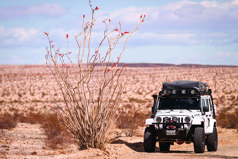
The OVRLNDX Jeep parked next to an Ocotillo
The exploration opportunities the Anza Borrego Desert offers are endless and perfect for both the fulltime overlander doing cross-country travel and the weekend warrior on a quest for adventure. In my case, the journey continues, exploring and searching for that amazing place and epic off-the-grid camping spot in this amazing area in the southern California desert.
Planning an adventure journey to the Anza-Borrego Desert State Park
Visiting the Anza-Borrego Desert State Park should be on every off-road traveler’s bucket list. The park offers an amazing landscape, hundreds of miles of hiking paths and thousands of acres of open off-road trails. The park is free to visit, but if you are planning on parking in the popular hiking and visitors’ parking areas you must pay the day use fee of around $10. You can purchase this at the visitor center.
I like visiting between the months of October and early May because of perfect weather. Something I recommend you experience at least once is the desert flower “Super Bloom.” This event happens between late January and March and usually lasts a few weeks. During this time, you get to see a beautiful display of color and a desert full of life, but beware, it gets crowded.
When planning a trip to this amazing place, it’s vital to bring lots of water and a four-wheel drive vehicle with good ground clearance and in perfect mechanical shape. It’s always a good idea not to travel alone and to make sure that every vehicle has its own recovery gear on board. I recommend having a map of the area on hand or downloaded onto an electronic device capable of working without cellular signal. Campfires are permitted in the area only when done in a metal container; make sure to bring one on board. I always buy wood locally, as this prevents spreading foreign pests. The use of wood pallets as firewood is prohibited; it is also prohibited to burn wood gathered in the area. Because of the lack of humidity, the desert does not produce enough bacteria to break down waste matter, so I always recommend packing all waste and firewood ashes in a proper container for later disposal.
This place is a go-to for any adventure lover. From the astrophotography enthusiast in search of that epic shot to the community of people dedicated to keeping Mother Earth free from litter. Areas like Fonts Point, Pumpkin Patch, Mud Caves, etc. make this destination a favorite for many. One reason why this place is one of my favorite camping destinations is because it is filled with wild camping spots. Plan a visit to this beautiful desert place, you won’t regret it.
OutdoorX4 Magazine – Promoting responsible vehicle-based adventure travel and outdoors adventure


