Spanning nearly 400,000 acres the Talladega National Forest in Alabama has a variety of vehicle-based and outdoor exploration opportunities
We knew we had our work cut out for us. Our sights were set on Talladega National Forest’s Skyway Motorway, and facing its challenges would make for an eventful and memorable weekend.
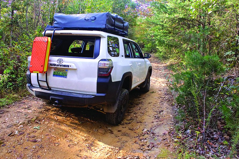
It was August when my new friend, Freddy Taul, and I began our expedition in the Talladega National Forest, which spans almost 400,000 acres across the state of Alabama. Winding through it is the Skyway Motorway, a 27-mile trail made up by forest service roads 600-1, 600-2 and 600-3, with dramatic elevation changes and plenty of rocks and water. Besides a vague forum post online, we were virtually driving blind. However, the GPS on my 2015 Toyota 4Runner managed to pick up the road, making navigation much easier, even with trees blocking the signal periodically.
We rolled up to the head of the trail at FS 600-1 around 4 p.m., and began to understand in part why this trail is not widely known. The trailhead is at the apex of a curve in the road and proceeds straight up a hill. In other words, if you’re not looking for it, you won’t notice it. Thankfully, we did find it and our adventure soon began.
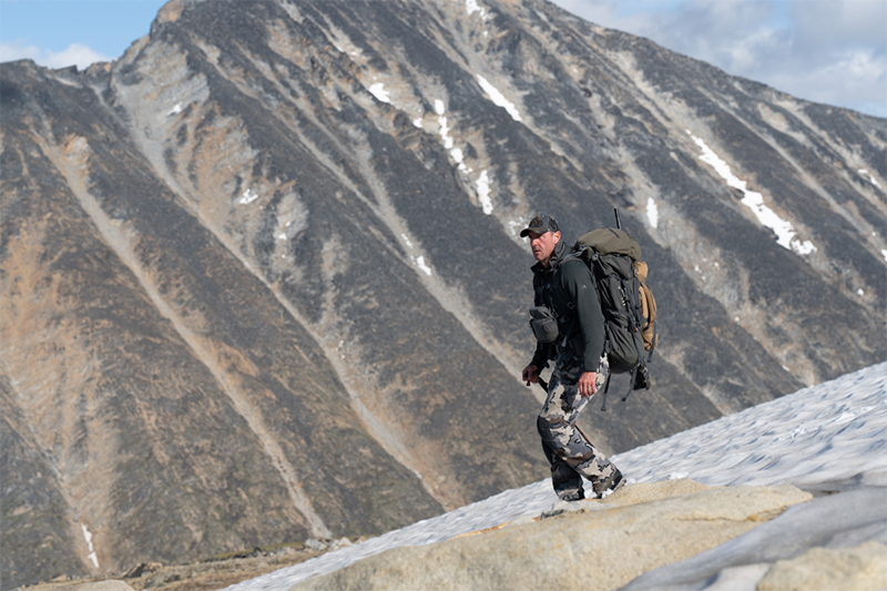
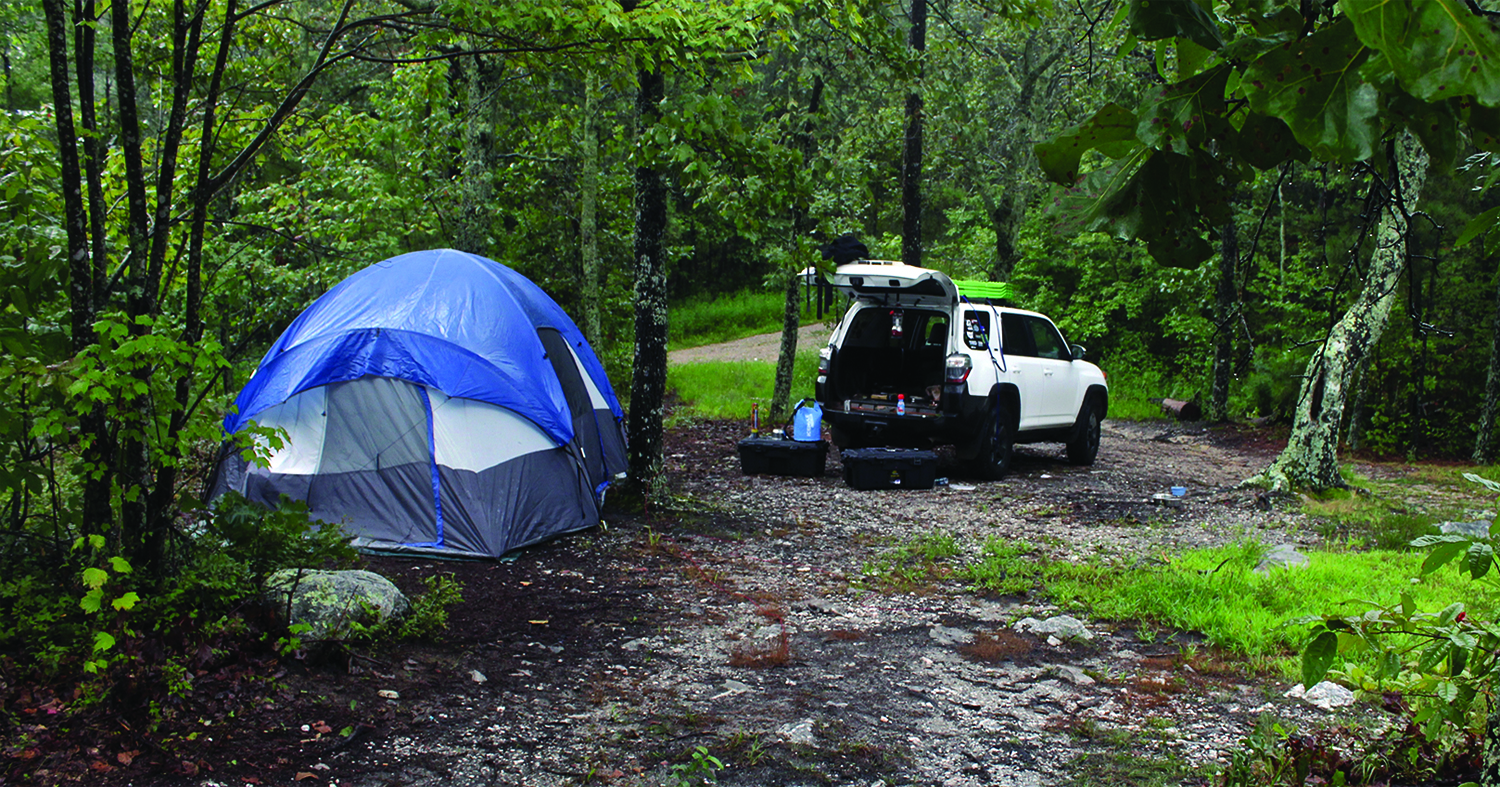
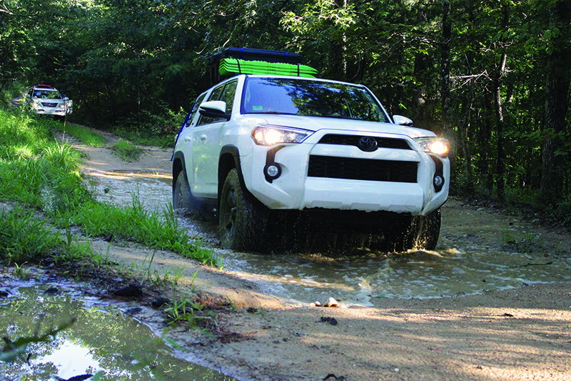
The long summer day gave us roughly four hours to cover the seven miles between us and our campsite, located on a bluff overlooking the forest. Confidently, we headed off down the trail only to learn how soon we and our vehicles would be tested. The first 500 yards of the trail were about as tough as driving up your own driveway. The next 12 miles were a different story. The trail, if you can call it that, is scored with massive washout ruts and miniature lakes which, in places, swallow the road entirely. It was much more than we had anticipated getting into, as we were both driving stock vehicles, though with aftermarket tires. Freddy was in his 2006 Lexus GX 470 and I was driving my 2015 SR5 4Runner.

The key for us to make it without body damage was to take it slowly, painstakingly slow at times. The routine went as follows for the seven miles to the campground: Walk the trail, choose our lines, place recovery boards if necessary, walk back, then drive that section. After the first hour we had covered just over a mile. Obviously, this pace would not allow us to make camp in time.
After 30 minutes more of scouting and driving we caught a break. A clean section of road allowed us to make up lost time before arriving at our first water crossing, a small pond formed in the road from the previous day’s heavy rains. We decided the best course of action was to first wade through the water to test its depth and feel for large rocks or logs. After determining it was safe to cross, we decided to take advantage of this rather fun opportunity and take some pictures of the rigs splashing and making waves through the murky water. After a bit of fun we remembered that time was not on our side and we made haste toward camp.
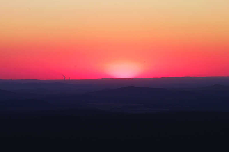
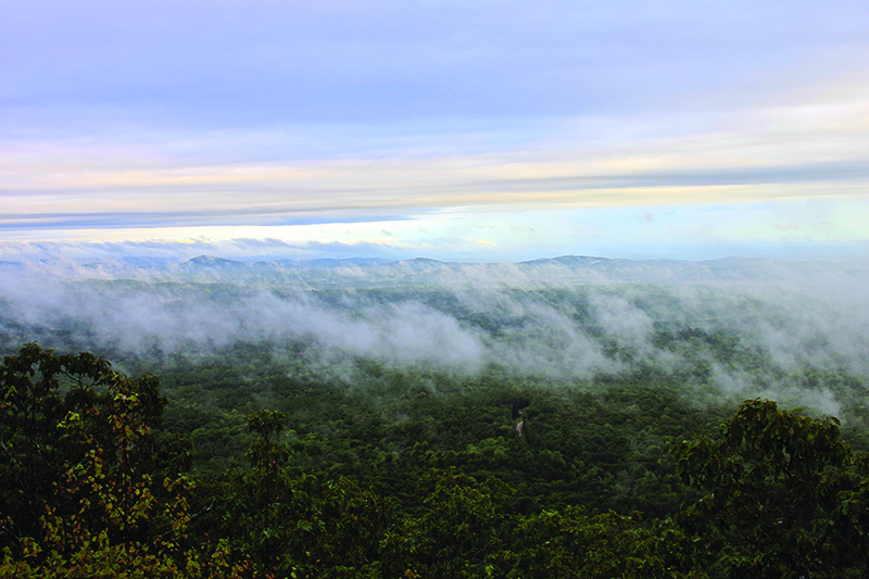
Over the next two hours we worked our way around three-foot deep gouges in the earth and several more collections of water we decided not to drive through. Roughly a mile from camp we came across an opportunity that we simply could not resist. Located at the top of a ridge, some 2,100 feet above the earth’s surface, is a power line cut straight over the mountain and through the forest. We stumbled upon this amazing sight at the perfect time as the sun was in the process of setting, illuminating all of creation in a brilliant golden glow. Taking in this moment was much more important than having adequate light for setting up camp, though we may have spent a little too much time soaking in this amazing view, if that’s possible.
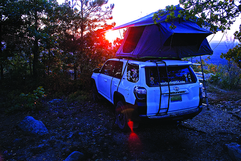
As the sun set we made the final push to camp. Lucky for us the next mile was the most subdued section of trail, allowing us to maintain a higher speed. Arriving at our campsite, we knew we made a good decision. As the sun hit the edge of the earth we snapped some photos and then set up camp with what little daylight we had left. Once camp was set, we whipped up a quick meal of hot dogs before parking our chairs on the edge of the bluff. We watched storms roll in and spoke of life and our goals as overlanders around a dim lantern. There is nothing quite as amazing and un-nerving as sitting on a bluff at 2,000 feet watching a southern summer thunderstorm.
That night we were lulled to sleep by the pitter-patter of rain on the tent, then awakened by flashes of lightning and claps of thunder. This is one of the scariest, yet most majestic, things I have ever experienced on an overland expedition. Around 5 a.m. we decided to abandon the flimsy tents and retreat to the cars to weather the last of the storm. Sleep was elusive, so I found myself recording video and snapping pictures while sitting in the car.

Around 6:30 a.m. the storm broke, revealing one of the most amazing scenes Alabama can offer. We found ourselves in a unique position; the fog from the storm was pushed down the side of the mountain below us while the clouds were just above our heads. This is an experience I will not soon forget and may never experience again. As we cooked breakfast out of the back of the 4Runner the winds kicked up, pushing the fog up and over the bluff, exposing the forest below and the sky above. Despite a miserable and ominous start, it turned out to be quite a morning!
Once properly caffeinated, we took advantage of the location and newfound sunlight to take some “glamour shots” of the rigs! Far too many pictures later, it was time to pack up camp and press on, if we were ever going to finish the route. The remaining four miles to the end of the first section went like clockwork, only taking about 40 minutes. The sun shone through the trees, hitting the misty air and making for a beautiful drive out of camp. As we rolled onto pavement and across the highway to the next section of trail we had no idea what awaited us.
600-2 is the most un-maintained section of the Skyway trail system. We were greeted with a small river running down the middle of the trail from the rain of the night before. We knew immediately this would be slow going. The road was washed away to little but the ancient rock that makes up the foothills of the Appalachian Mountains. Having no body armor in the form of rock sliders or off-road bumpers, we proceeded with extreme caution.
Traversing the deep crevasse that wound back and forth across the trail and negotiating small boulders proved difficult and time consuming. Two hours passed and we found ourselves only .7 miles down the trail. It was decision time. It was nearly noon that Sunday and we both had multi-hour drives home and work the next day. Our pride wanted to press on but better judgment won the day. We turned the rigs around and headed back down to the pavement. I wouldn’t say the road defeated us, but it did gain our respect. While a little disappointed and frustrated, we had no regrets, we left with plenty of lessons learned, and overall had a great trip.
Since this trip I have returned to Skyway Motorway, mostly 600-1 and our campsite. I have grown to respect the difficulty of the drive and the beauty of the area. I also learned that 600-3, the section we did not get to, is a well maintained gravel road that anyone in any vehicle could enjoy. That being said, the Skyway trail is, and will forever be, a place of great significance to me and the emerging overland community in the south. It epitomizes what overlanding can be: A good trail that can be navigated by any stock 4×4 with the proper technique. A truly accessible trail for all, with amazing views and one hell of a campsite!
OutdoorX4 Magazine – Promoting responsible vehicle-based adventure travel and outdoors adventure