Taos, New Mexico and the surrounding areas are a gem for exploration
The sign read, “National Forest Closed.” Hmmmm…. I continued driving down the road. Never had I seen a sign like that. Wait, another sign appeared a few miles later: “National Forest Closed.” Okay. I was totally confused and pulled over to discuss options with my friend, Barb, who was following me. We parked on the outskirts of Cuba, New Mexico, to talk.
“You saw the signs, right?” I asked Barb.
“Yeah, I haven’t seen a ‘National Forest Closed’ sign since my fire fighting days,” replied Barb.
“Let me call the Carson National Forest number,” I offered. A few minutes later, I ended the call, somewhat confused. “Well, we can drive through the forest, but we can’t stop or do anything along the way,” I explained. Our plan was to camp and then hike to a remote hot spring in the forest, but the dry winter of 2017/18 resulted in extremely dry conditions all over the West. Spring had not brought rain and, as a result, the forest was a tinderbox, waiting for a spark.
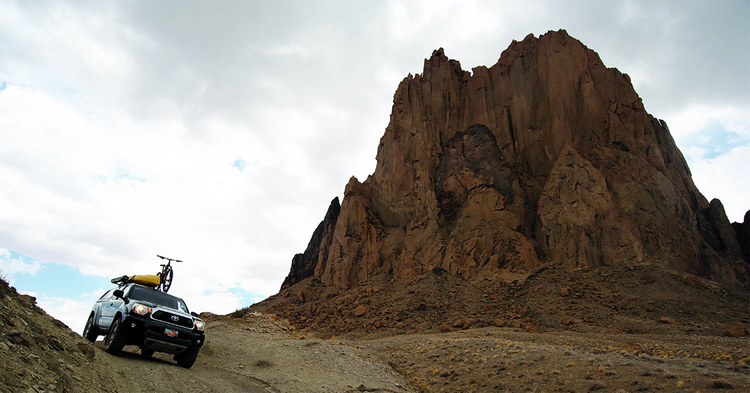
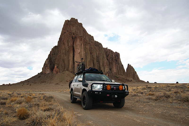
This was my first long-term visit to New Mexico. So far, the adventure had not been a disappointment. Shiprock and Chaco Canyon were highlights, places of remarkable beauty and history. Our plan was to explore Carson National Forest, but with its closure, we revised our plan.
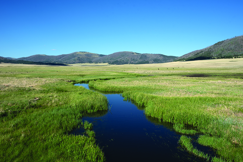
I scanned the map and determined a route. Our first stop was Valles Caldera National Preserve. This enormous caldera was formed 1.25 million years ago when a volcanic eruption occurred and forever altered the landscape. The 13-mile caldera rests at an elevation of more than 8,000 feet, and the surrounding volcanic peaks rise to over 11,000 feet. We entered the preserve on a gravel road and immediately spotted a herd of elk.
A nice volunteer welcomed us at the small visitor center: “So sorry, but the preserve is closed.”
“Oh, so we can’t check out the visitor center?” I asked.
“No, you are more than welcome,” the volunteer explained, “but you can’t venture onto the preserve. It’s been so dry, and the national forest is closed. So, too, this preserve.”
We investigated the small, informative visitor center and then, from the front porch, observed something.
“Who is out there?” I asked.
“That’s National Geographic and they are in the process of filming prairie dogs for a documentary,” the ranger informed us.
That got my attention. I immediately grabbed my telephoto lens and began looking for the cute, mischievous little animals. Within minutes an enormous badger came out hunting for dinner. The prairie dogs began squeaking and making high-pitched noises to warn the others. The hunt was on. Within minutes the grasses were calm and quiet, with no prairie dogs in sight. That was our cue; we left as the setting sun’s rays over the caldera and its beautiful grassy meadows created magic hour.
The road twisted and turned, dropping thousands of feet before we saw a sign to Bandelier National Monument. The campground was situated within a juniper and pinyon pine forest. Campgrounds aren’t my first choice, but this one was peaceful and quiet. Really, no one was there. Grateful and confused, we picked a terrific site and set the fire to cook dinner. While we chatted and drank beer, we commented on the beautiful views and the quietness of the campground. The stars eventually illuminated the sky as I snuggled into my bag atop my cot, while Barb climbed into her tent.
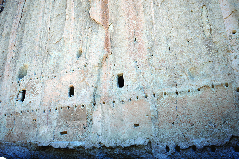
Bandelier National Monument is a “diamond in the rough.” Barb and I didn’t see anyone else there the following morning and, as we descended to the canyon floor, I thought to myself, “Where is everyone?” The canyon is filled with towering shade trees, and the Southwest beauty “stares” visitors in the face during the descent to the visitor center. The volcanic tuff canyon walls, along with the trickling water of Rito de los Frijoles Creek, make the setting serene.
Barb and I hiked the main trail that leaves from the visitor center. Immediately, we spotted ancient ruins built into the cavities of the canyon walls. The Ancestral Puebloans called the canyon home from 1150 to 1550. But after 400 years of use, the canyon and its resources couldn’t sustain the human impact, so the Ancestral Puebloans left. They traveled farther south along the Rio Grande River. Barb and I paid less attention to the historical facts and more attention to which foot would step on which rung of the ladders.
The park service has installed numerous replica ladders so that visitors can access the ruins and living quarters. We climbed them cautiously. As I carefully placed each of my feet, I thought about the ancient ones climbing up and the down their ladders daily. They fell, right? What did their children do? We finally reached the Alcove House Kiva and marveled at the ceremonial structure. Archeologists believe that kivas were special dwellings that were used for special ceremonies and spiritual celebrations. This kiva is perched in an alcove high on the canyon walls, roughly 150 feet above the canyon floor and is reached after climbing four ladders We admired the canyon views as we sat in silence. Did they do the same? Or, were they just trying to survive? Barb and I weren’t in survival mode; we savored the surroundings and environment of Bandelier.
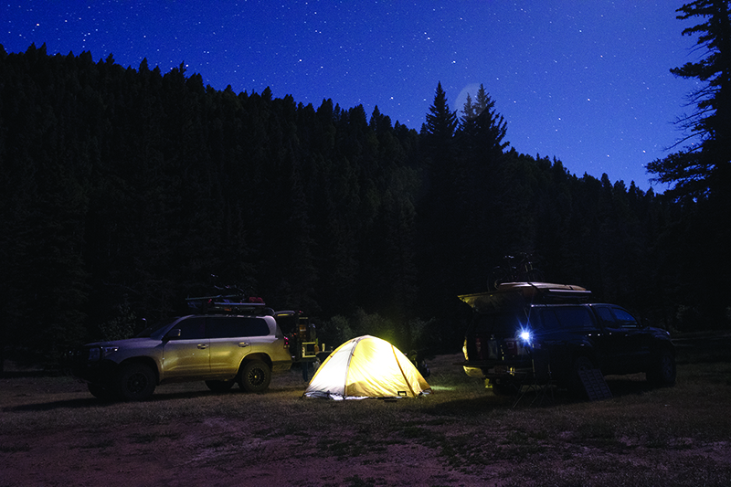
After leaving Bandelier, we traveled on Highway 76 toward Taos. There are two main routes to Taos. After numerous recommendations, we chose the “high route,” through the mountains. Within minutes after leaving the small town of Chimayo, I felt like I was traveling in rural Mexico. Numerous churches and markets dotted the roadside. Road signs were written in Spanish. The forested landscape reminded me of northern Arizona. Enormous Ponderosa Pines lined the highway while the forest floor was covered inches deep with fallen pine needles. Barb and I took a turn off the paved highway onto a dirt road to look for a campsite. Within 30 minutes or so, a beautiful, green meadow appeared along a stream. A perfect place to set camp for the night. Dazzling stars popped out as Barb and I sipped beer and savored the warm, summer night.
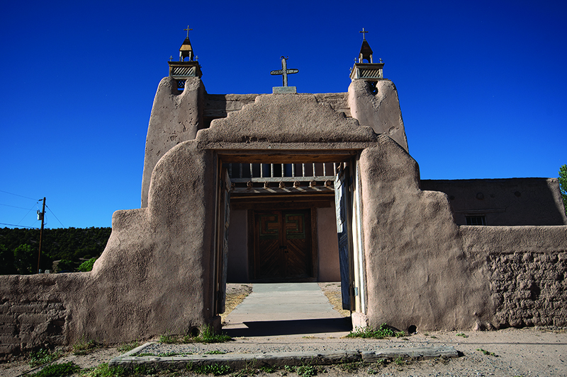
The next day, we awoke to clear skies and warm temperatures. We packed our vehicles and descended 3,000 feet to the city of Taos. Once we entered the city limits, the streets became narrower. Beautiful southwestern architecture appeared everywhere. We stopped to stroll around town and spotted a sign for the Kit Carson museum. Our curiosity piqued, we entered. The museum was the actual home of the famous, infamous Kit Carson. His life was a twisted ride of ups and downs. But, that’s another story. Barb and I enjoyed the historical significance of the museum and the many displays. Outside, the weather was ideal, so we decided to mountain bike.
Taos is known as a mountain biking destination. We knew we wanted to ride, but didn’t exactly know where. We stopped briefly at Taos Cyclery and found the staff friendly and informative. While they added some new sealer in my tubeless tires, we chatted about where to ride. They suggested some loop rides on the Rift Valley trails, and off we pedaled.
The evening light cast a warm, orangish glow over the high desert sagebrush as I glanced over the rim to see the water of the Rio Grande River—stunning! But, I needed to focus on the trail. I felt refreshed as my heart rate increased and sweat dripped from my forehead. Barb rode one way, I another. We planned to rendezvous back at the vehicles when finished. I pedaled—fast. I relished the slight breeze and rolling terrain. The Rift Valley trail system incorporates many loops, making it easy to continue on another loop or return when tired. Conscious of the waning light and not wanting to finish in the dark, I headed back to my vehicle.
“How was it?” Barb asked.
“So much fun,” I responded. “Just an absolute blast. The trails are a hoot!”
“Let’s grab some dinner,” said Barb.
Taos is full of delicious eateries. We decided on La Cueva Restaurant based on the recommendation from the guys at Taos Cyclery. Barb and I chatted about the day’s adventures while we sipped on margaritas and ate chips and salsa. For the following day, we planned for a shuttle van to take us up the mountain, so that we could ride down the South Boundary Trail. We talked logistics and expectations as our food arrived. I can’t remember what Barb ordered because I was so engrossed in my shrimp enchiladas. Delicious! It was one of the best meals I had eaten in a long time. We returned to our campsite to get some rest for tomorrow’s ride.
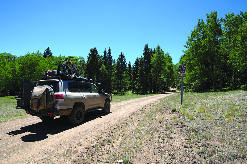
The following day we hooked up with Turquoise Tours for a shuttle ride to Garcia Park. The “park” is actually a stunning alpine meadow about 3,000 feet above the valley floor. We unloaded the bikes and prepared for fun: the down. Barb and I fine-tuned our packs and gear. We clipped into our pedals and started the ride. The South Boundary Trail is known as one of the best rides in Taos, and all of New Mexico for that matter. As the single-track carved its way through Aspen groves and other gorgeous “parks,” I understood why it deserves so much notoriety. The trail was fairly smooth and incredibly fast. I hooted and hollered, smiling through the entire descent.
We biked through the high, alpine forest into the lower pinyon and juniper tree forest. The landscape changed dramatically, after about 2,000 feet of down. Barb and I slowed the pace as the trail became rockier. With another 1,000 feet of descent, a blown tire and/or an injury would be an awful way to end the day. But 30 minutes later, we arrived unscathed at our vehicles. We felt that we deserved a refreshment and opened a cold beer from our coolers. With tired legs and smiles on our faces, we sat to enjoy the views of the Sangre De Cristo Mountain Range, the mountains we had just “conquered.”
“I’m hungry. You?” I asked Barb.
“Yes, starving.” Barb replied.
We packed our gear and bikes and traveled to the outskirts of Taos to the Taos Mesa Brewery. The drive took us into the high desert, away from the city and toward the Rio Grande River. The Taos Mesa Brewery has two locations, and we headed to The Mothership location. Yes, The Mothership, and it lived up to its name. Live music played in the background on two separate stages. Inside, one band was playing, while outside another. We savored outstanding steak tacos and drank a few of their brews. The place had a nice, comfortable vibe to it. Unusual setting, unusual place, but a must-do when visiting the Taos area.
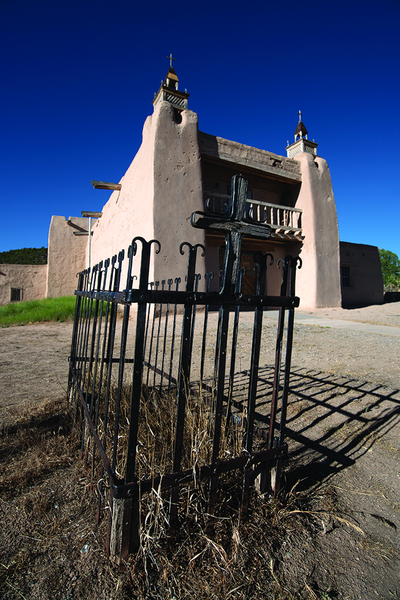
The evening sun was low in the sky, which signaled it was time for us to leave and head north. We still had places to visit and adventures to experience. Where to? What was next? As we drove north toward the Colorado border, I glanced back to admire the Taos Valley once more. The Desert Southwest is truly a remarkable place, and the Taos area holds many gems. We both resolved to visit again.
Trip Insights
*Any stock 4WD vehicle will do just fine.
*Summer months are prime time to visit the area. Temperatures can be warm and maybe even hot in the summer months, but the high country is dried out so vehicle travel on forest roads should be unimpeded.
*If time allows, check out Red River, New Mexico, just north of Taos.
*Valles Caldera National Preserve—a stunning spot for wildlife viewing and hiking.
www.nps.gov/vall/index.htm
*Bandelier National Monument—a great monument that offers nice camping options as well as short but rewarding hikes.
www.nps.gov/band/index.htm
*Taos Cyclery— an outstanding bike shop offering great, friendly service.
www.taoscyclery.com
*South Boundary Trail—a must do ride. Intermediate to advanced skills required. Camp in one of the “parks” and bike the trail as an out and back.
www.mtbproject.com/trail/4073073/south-boundary-trail-164-imba-epic
*Turquoise Tours—if you need a shuttle, give them a shout. Friendly service, clean vehicles, and knowledgeable staff make this shuttle worthy.
www.turquoisetours.us
OutdoorX4 Magazine – Promoting responsible vehicle-based adventure travel and outdoors adventure


