The Sonoran Desert’s Devil’s Highway is inhospitable and flows along the U.S./Mexico border in southern Arizona
With my head down, I hiked the sandy wash, carefully monitoring each footstep. The temperature was pleasant, in the low seventies, and a blue sky filled with white, puffy clouds blew eastward. My friends Sam, Craig, Shane, and I looked for footprints. Signs of others? No, not of our group, but rather footprints of migrants walking north. We were traversing the Arizona/Mexico border, driving on the notorious El Camino del Diablo route, known by many as The Devil’s Highway.
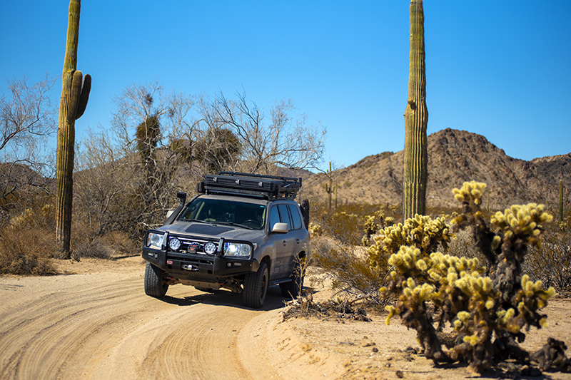
Just enjoying the ride
The El Camino del Diablo (El Camino) route, traversing the southern border of the United States, is considered a historic route. Its origins can be traced to the Spanish Conquistadors when they headed northwest from Mexico to California in the 1500s in search for gold. Today, it’s roughly 130 miles of remote road traversing the Sonoran Desert, Cabeza Prieta Wilderness, Goldwater Bombing Range, and Organ Pipe National Monument. It also serves as a major route used by migrants crossing the border from Mexico. In late February, with a group of friends, I set off to explore and experience this remote, historic route.
“I don’t see any prints!” Sam called out.
“Neither do I,” replied my friend, Craig.
We visited briefly with U.S. Border Patrol agents who informed us the illegal activity crossing from the border was low. Still, we felt a bit uneasy. Here we were, a group of friends, on a vacation, while migrants could be crossing the border, trying to make a better life for themselves, walking and traveling through one of the most inhospitable places in the U.S. We didn’t fear the migrants per se, but wondered what we would do if we encountered some. Would we offer water? Supplies? Or, would we look the other way? We were nervous, why? With no concrete answers, we continued hiking this stunningly gorgeous and infamous desert of southern Arizona.
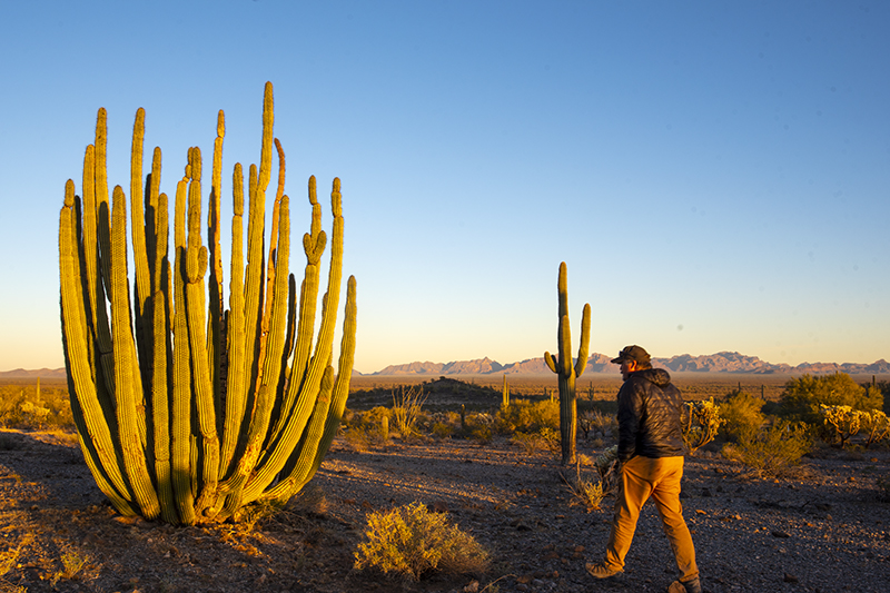
Organ pipe cactus are simply stunning
My friend, Shane, a professional photographer from Flagstaff, served as our guide on this trip. The Arizona backcountry is his playground, and he invited a few of his Utah buddies to join him on this journey. I motored south on I-15 with our mutual friends, Sam and Craig, and met up with Shane outside Quartzite, Arizona. Shane led us into the Kofa Wildlife Refuge, which served as a scenic starting point. At sunset we exchanged idle banter, numerous exaggerations, life happenings, and family drama as we warmed by the glow of a fire under the star-filled night sky.
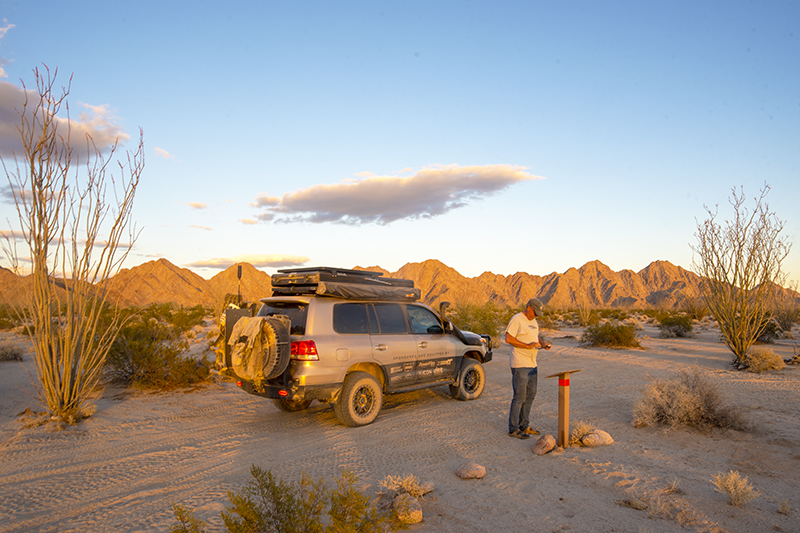
Craig reading one of the informational signs along the El Camino
The following day, we had a short drive to Yuma, Arizona, where we bought a few last-minute items before airing down our tires on the outskirts of the Barry Goldwater U.S. Bombing Range and the beginning of the El Camino. Honestly, I had mixed emotions as we traveled southeast. The desert was strikingly gorgeous, but the idea and possibility of people dying on this route as making their way north into the U.S., made me pause and think. I was a tourist/visitor, “playing” around in the desert. A desert that has taken numerous lives.
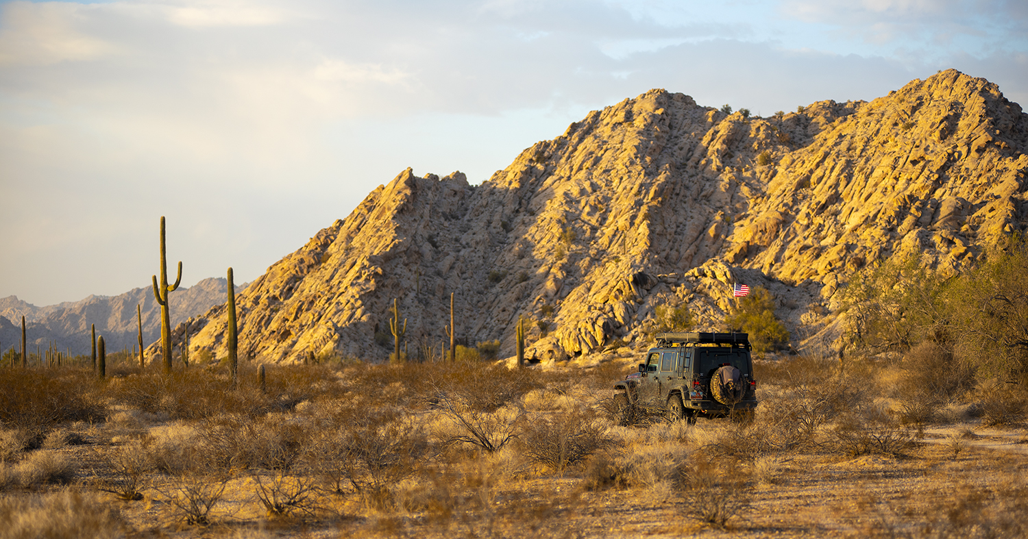
The El Camino stretches out from Yuma through the Sonoran Desert to Ajo, Arizona. The vast Sonoran Desert runs from California and Arizona down into Baja, Mexico. It’s famous for the millions of Saguaro cacti that grow in this harsh, hot desert. With low humidity, lack of water sources, and extreme exposure to the sun, the Sonoran Desert presents a difficult challenge to traverse and experience. Lucky for us, the February weather was perfectly mild.
As we drove east, the setting sun created a stunningly beautiful glow over the desert — a captivating, soft light inviting us further into its depths. The ride featured many whoop-de-dos, and our vehicles’ suspension systems worked overtime. Along the way, we stopped at a few informational signs about military training exercises in the area, warning us not to deviate from the main track. We continued on and looked for a pleasant campsite tucked in the rocks of theTinajas Atlas Mountains.
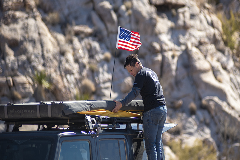
Sam packing the tent, ready for the day’s adventures
“Guys, look at this marker,” Shane called over the radio. As we each pulled in behind Shane’s Toyota Tundra, we noticed that this marker was really a life saver. Shane informed us that along the route, the U.S. has erected numerous life-saving measures for the migrants traveling north through the desert. This marker featured an emergency/help button and informed the user, both in English and Spanish, to stay put after pushing it and help would be on the way. We pondered the desperation a migrant might experience to push the button. Later, we turned into a lovely rock outcropping and set up camp.
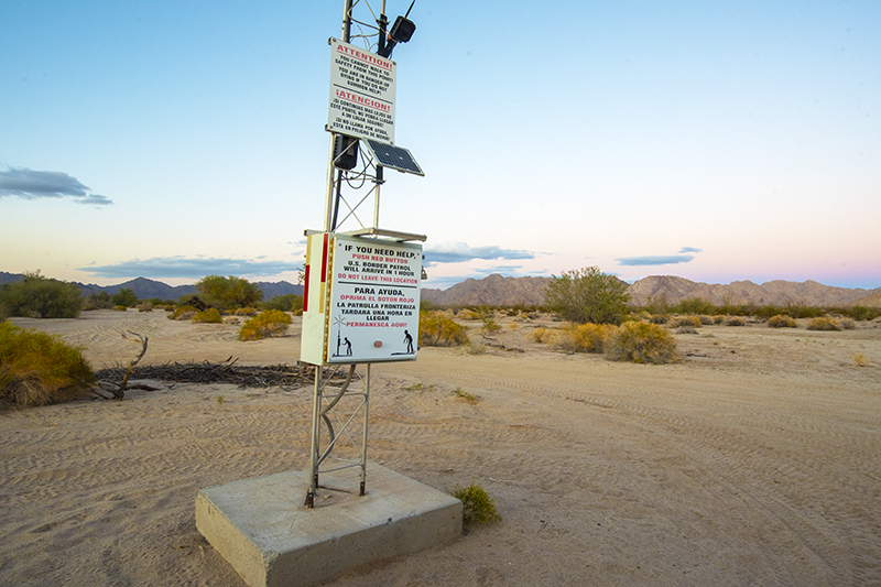
A rescue beacon along the El Camino
Around the fire, we discussed the plight of some migrants who try to cross this desert for a better life in the U.S. What can be done? Would I cross the desert or find another way? Has the wall helped? What should we do if we meet someone out here? These were just some of the questions we considered. No easy answers. This exploration vacation on the El Camino prompted all of us to wax philosophical and appreciate this unique experience.
The following morning, we awoke to a light and pleasant sprinkle. The desert literally soaked all the water. Flowers started to bloom and the desert came “alive.” As we drove out of camp, a Yuma radio station reported that it was the first measurable precipitation of the new year. We felt lucky to see this dry land experience a refreshment. We continued eastward and followed the road up and over a mountain pass. Each of us shifted into 4-low a few times and crawled up and over the rocks and loose gravel. We reached the pass, and the road improved. Soon, we were taking pictures of a strange and interesting desert statue—one of the oddities and unique finds in this harsh landscape.
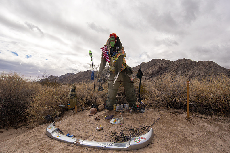
A desert oddity? A work of art? You be the judge.
After taking a few photos, Shane pointed to some rocks for us to visit. Rocks? Okay, off we went. The El Camino traverses a variety of diverse topography. Mountains with names such as the Copper Mountains, Cabeza Prieta Mountains, and Growler Mountains are all worth exploring. The area reminded me of Joshua Tree with rocks that “beckon” the visitor to climb and explore. We gladly accepted the invitation and hiked and climbed the rocks, soon spotting enormous pools of water.
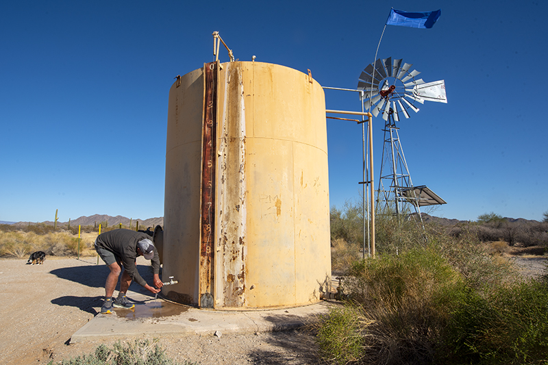
Numerous blue flags along the route mark water sources and wells
The tanks, as they’re called, have been used for hundreds of years. The natural rock bowls provide an excellent water cache. Travelers and animals use the tanks to provide much needed hydration in an environment far from hospitable. Unfortunately, some discovered the tanks dry and perished from dehydration. Sam, Craig, and I continued to wander and climb. Shane went off to take a few photos of the Saguaro cacti.
“Look, you see those?” I asked.
“What?” Craig responded.
“Over there, the rock art and the grinding holes.”
We examined the signs of the past, and I marveled at these historic finds. Hundreds of years ago, Native Americans roamed this area and used the tanks for water and this place to grind their corn. Their rock art told a story.
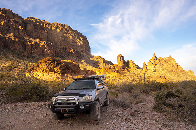
The light show deep in the Kofa Wildlife Refuge
The afternoon sun was beginning to set, and daylight waned. Shane asked if we wanted to see the wall. The American wall has been in the news so much, so we decided to check it out. Shane pointed out the wider road in places, which allowed easier access for the construction crews and equipment. We motored down the road that was at least three lanes in width, looking for the wall. Soon enough, we spotted the large, rust-colored metal wall. What amazed me was the wall, at this point, didn’t appear to be a deterrent for entry. One could easily walk to the end of it and cross the makeshift border. I perceived it as an enormous eye sore in this otherwise beautiful desert. Granted, we only visited one short section; however, we all felt a bit underwhelmed as we walked back to our vehicles.
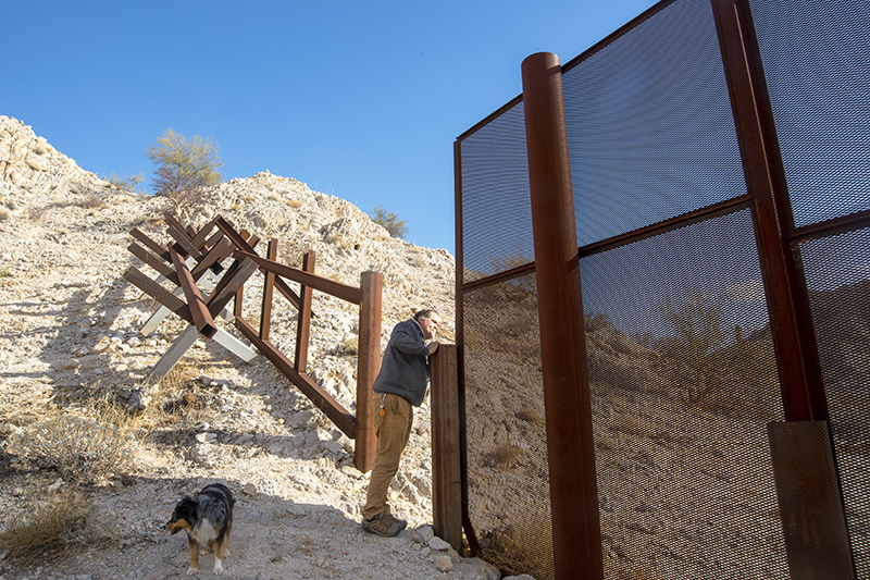
Shane looking into Mexico. Money well spent?
From there we made camp close to the Sheep Mountains. A warm glow shone over the landscape as the sun set in the west. We started a fire, basked in the evening light and our surroundings. Shane cooked steaks and crunchy asparagus over the hot embers of the fire. Our conversation, once again, turned toward the many who make this difficult journey northward for a better life. I had just read The Devil’s Highway by Luis Alberto Urrea, the horrific account of thirteen people dying from an attempt to cross this unforgiving landscape. It left me with too many questions and no definitive or easy answers. We watched the juniper embers burn deep orange and turned in for the night.
The El Camino is not to be taken lightly. Bring plenty of food and water and all other necessary supplies. We were reminded of this the following day when we passed one of the wells along the way. Yes, a few wells exist along the route, and water is pumped into large storage tanks. I opened one well’s valve, and cool water flowed. I filled my LifeSaver jug, and we continued. The El Camino narrowed as we swerved in and around towering Saguaro – some over twenty feet tall. Craig found a mylar balloon stuck to a prickly pear cactus, and we pondered its origins. He tossed it in his trash bag and we continued on.
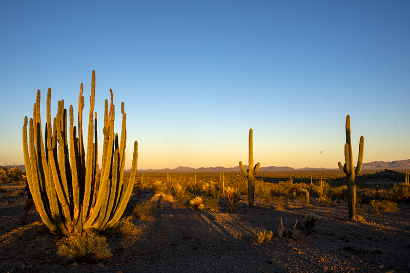
Magic hour along the El Camino
Late in the day, we approached the end of our route. The beauty of the Sonoran Desert showcased itself yet again. Warm, soft light hit the vegetation, and long shadows formed. Just outside of Ajo, Arizona, we stopped to watch the final moments of daylight. Shane started the fire, and I prepared dinner for the group. With the crackling and warmth of the fire, we chatted about the day’s sights and sounds. In the distance, lights from a border patrol truck raced through the desert, flashing blue and red. What was happening? Did the agent spot a few migrants? More unanswered questions.
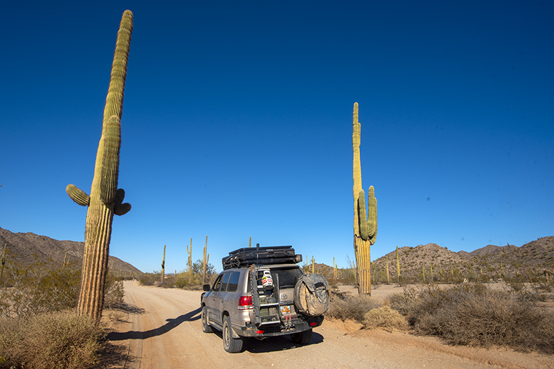
Driving among giants
The El Camino is a worthwhile overlanding adventure. With the right vehicle and supplies, the vast beauty of the Sonoran Desert will captivate the adventurer. Signs of the past will present themselves, and the traveler will experience numerous invitations to adventure. However, don’t be alarmed if you leave the route with more questions than answers.
Travel Tips for The Devil’s Highway:
● Bring all necessary supplies.
● Cell phone coverage is spotty so plan accordingly by bringing radio communications in case of an emergency.
● A four-wheel drive, high clearance vehicle is necessary.
● November through March, depending on weather, can be an ideal time to travel. Absolutely avoid the summer months as temperatures are unbearable
● A free permit is needed to travel across the Barry Goldwater bombing range. Visit the following website for more information: www.luke.isportsman.net
● Avoid solo travel.
OutdoorX4 Magazine – Promoting responsible vehicle-based adventure travel and outdoors adventure


