The Rim Rocker Trail is an exceptional option for those looking for an expansive vehicle-based adventure
Summer family road trips are full of ups and downs, making memories along the way. And, depending on the itinerary, state border crossings are common,usually with a sign welcoming the traveler to the new state. Many times there’s a pull-out to take the obligatory “welcoming state sign photo,” but that was not the case with this trip . My wife, Louise, my daughter, Lilly, and I were cruising the dirt roads of the La Sal Mountains. We enjoyed watching the free-range cattle ambling roadside as well as the stunning scenery high above the deserts of Moab, Utah. Louise spotted a green sign; it read “RR”, meaning we were on the right course, the Rim Rocker Trail. Onward.
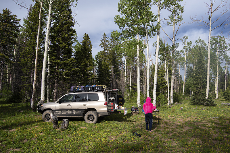
Pleasant temperatures and green grass welcomed us . . . uncommon in the slickrock wonderland of southeastern Utah. However, the La Sal Mountains tower to almost 13,000 feet above the tourist town of Moab and provide a unique alpine environment over the slickrock wonderland. The gravel road was fairly smooth but we stopped to decrease the tire pressure for a smoother ride. The Rim Rocker Trail weaves in and around massive aspen and Ponderosa pine trees. I am not a botanist, but the forest appeared healthy. We traveled eastward, eager for discoveries along the way.
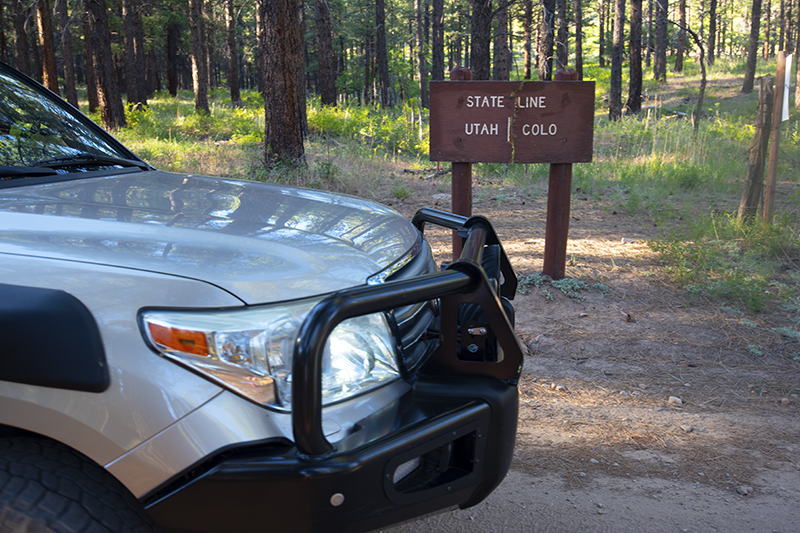
“There!” Lilly shouted.
“I see it, thanks.” I replied. Lilly had spotted the state border sign. It was a little anticlimactic because the sign was the size of a cereal box, but also fun, realizing few ways exist to sneak into a state via an overlanding route like this. The forest and grasses almost engulfed the sign. Utah on one side, Colorado on the other.

The Rim Rocker Trail, really a dirt road, is publicized by the cities of Montrose, Colorado, and Moab, Utah. It’s roughly 140 miles of dirt, gravel, and sandy roads complemented by 20 or so miles of pavement. The trail follows an east-west overlanding route between Utah and Colorado. Our goal was to discover the “goods” along the way, traveling from west to east. With no time constraints, we stopped for supplies in Moab and resumed our adventure.
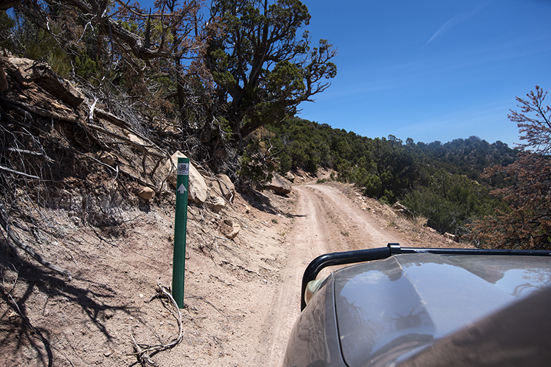
With temperatures in the upper 80s and an elevation of roughly 4,000 feet, the start of the Rim Rocker was warm. We quickly gained elevation and a reprieve from the heat. The prickly pear cacti and juniper trees were replaced by scrub oak and cooler temperatures. Soon we traversed the slopes of the La Sal Mountains. These towering mountains watch over the deserts of Moab, Utah. The highest peak, Mount Peale, rises to 12,721 feet and appeared to our northwest. The trail was easy to follow because of green markers along the way. Regardless, I downloaded the map via Gaia GPS, just in case. The road smoothed out as we gained elevation.
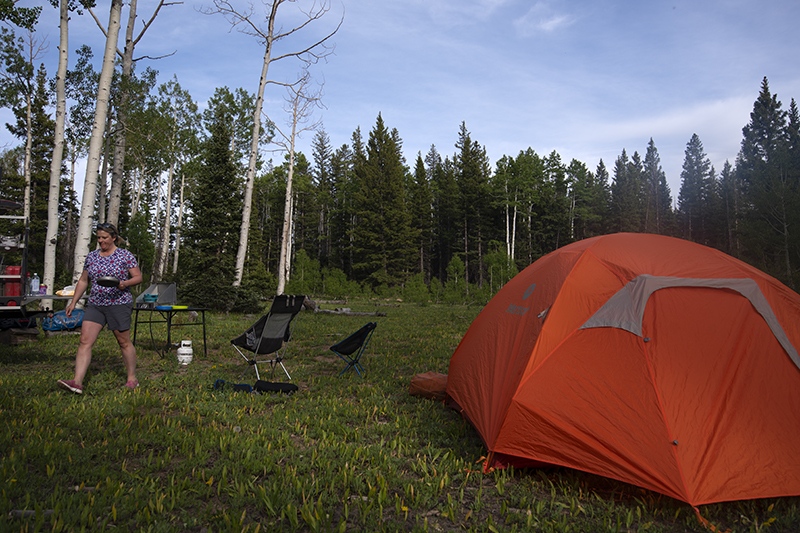
Lilly pointed out a sign for Buckeye Reservoir, which would be our first night’s camp spot. It appeared that we weren’t the only people escaping the desert heat and/or traveling the Rim Rocker Trail. The campground around the reservoir was full, but we found a nice, dispersed site farther along the shore. Perfect. Louise prepared dinner; I set up camp. As the sun fell behind the La Sals, a gentleman on a motorbike stopped to chat. He shared trail conditions to the east, while I shared conditions from the west. We were headed in opposite directions but shared a passion for adventuring and discovering new routes. With dinner complete, we savored the final rays of light before we crawled into our tent. Frogs in the lake lulled us into sleep.
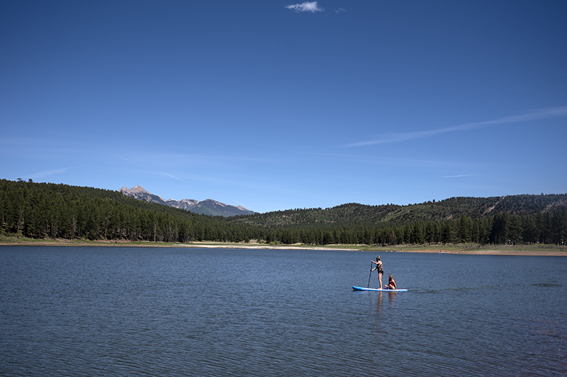
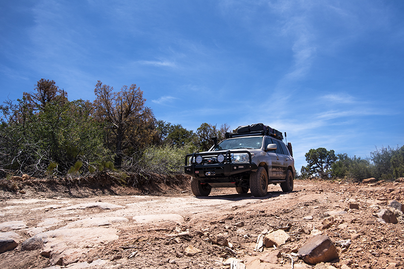
The next morning, while we sipped coffee, we inflated our paddleboards. We paddled the calm, tranquil waters of Buckeye Reservoir, which made for a very peaceful way to start the day. After breakfast, we swam and washed up in the water, then we broke camp. The Rim Rocker Trail quickly changed from alpine to higher desert, featuring landscape, sand and sandstone rock. My Land Cruiser carefully descended the natural rock steps. Four-wheel drive and high clearance are a necessity. We descended and ascended numerous small hills as the trail weaved in and around juniper and pinion pine trees. As we traveled high above the Dolores River, the temperature climbed into the lower 80s.

The Rim Rocker Trail is new but the roads have been here for years. Local four-wheel drive clubs started to determine how they could connect the various roads to establish a long route from the mountains of Colorado to the desert of Utah. The Montrose and Moab Visitor Centers offer maps and directions.
We exchanged trail conditions with a few fellows driving an outfitted Jeep Rubicon before descending to the Dolores River. The refreshing waters offered an excellent reprieve from the desert heat. We splashed and rinsed off our faces, then continued our journey. The trail “hangs” on the edge of a cliff or “rides” the rim. Ahh, “Rim Rocker.” The portion from the Dolores River to Naturita, Colorado, definitely lived up to its name.
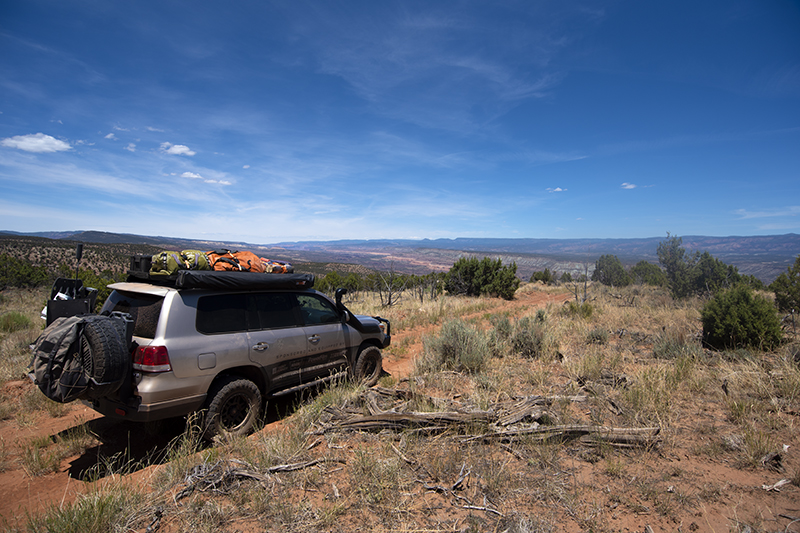
My ICON suspension soaked up the bumps of the trail as we looked down upon uranium mines from yesteryear. Sure enough, more green markers directed us as we got closer to Naturita. This was the only place to get a few supplies and fill the gas tank. Our supplies and fuel were sufficient, so we bypassed the stop. This was the only paved portion of the trail. The trail, road actually, climbed immediately after leaving Naturita, turning and twisting its way toward the Uncompahgre Plateau.
The Uncompahgre Plateau rises above the land some 10,000 feet. We watched our vehicle’s outside thermometer reading decrease as we ascended to the aspen trees and evergreens. The smooth dirt road signified that this area is heavily used, but we saw only one other vehicle during our search for a campsite for the night. An aspen meadow revealed itself and made for an excellent spot. I started a fire while Louise and Lilly prepared dinner. We enjoyed a glorious, cool evening in the mountains of Colorado.
I am not much of a morning person, so when the birds started chirping at 5:30 a.m., I ducked my head into my sleeping bag for another 30 minutes, then snuck out of the tent without waking Louise and Lilly. The Jet Boil roared to life and, within minutes, the water boiled. The early sun shimmered through the aspen trees as I slowly ground the beans to make the coffee I craved. I listened to the sounds of nature and viewed the serenity of the place. A quiet morning is hard to beat.
Louise prepared a breakfast of eggs and turkey sausage; Lilly snapped some photos of the campsite. We slowly took down camp and packed our belongings. I steered the Land Cruiser toward the east; the dusty rooster tails followed us on our way to Montrose.
“Whoa, look at that!” Louise yelled as she pointed out the window. The San Juan Mountains rose toward the cobalt skies to our south. Towns with such names as Ouray, Telluride, and Silverton lay at the base of the towering spires of granite. But, for another time.
We descended the plateau and spotted a paved road in the distance. A nice, large gravel lot was an ideal place to inflate our tires for the pavement. The back roads took us through the outskirts of Montrose. Large cottonwood trees towered over the road, and the green grasses signified that water was not a problem in the area. With a somewhat anti-climactic ending, we came upon Highway 550. Louise, Lilly, and I celebrated Father’s Day in a local eatery before venturing farther east toward the towering peaks of the Elk Mountains.
The landscapes of Moab and Montrose are different indeed. Take some time to find “the goods” in between. The Rim Rocker Trail does just that…exposing beauty and grandeur from red rock terrain to alpine flora and fauna. Yep, it’s all there. It’s your turn. Go adventure on the Rim Rocker Trail.
Trip Tips
*Spend at least two days along the route. Explore the beauty.
*Bring an extra five gallons of fuel.
*Use GPS mapping software to show exact locations and to avoid detouring onto the many side roads and tracks.
*There are many ways to access the trail, which can shorten its overall length.
*Pack all necessary supplies.
*Follow the lime green RR signs along the route.
Recommended Gear
*The Gaia mapping software already had the route mapped. Easy to use and follow. gaiagps.com
*Surftech Inflatable Paddleboard. An awesome way to experience high mountain lakes. Easy to inflate and deflate for storage. Surftech.com (See Issue 33 for paddleboarding insights.)
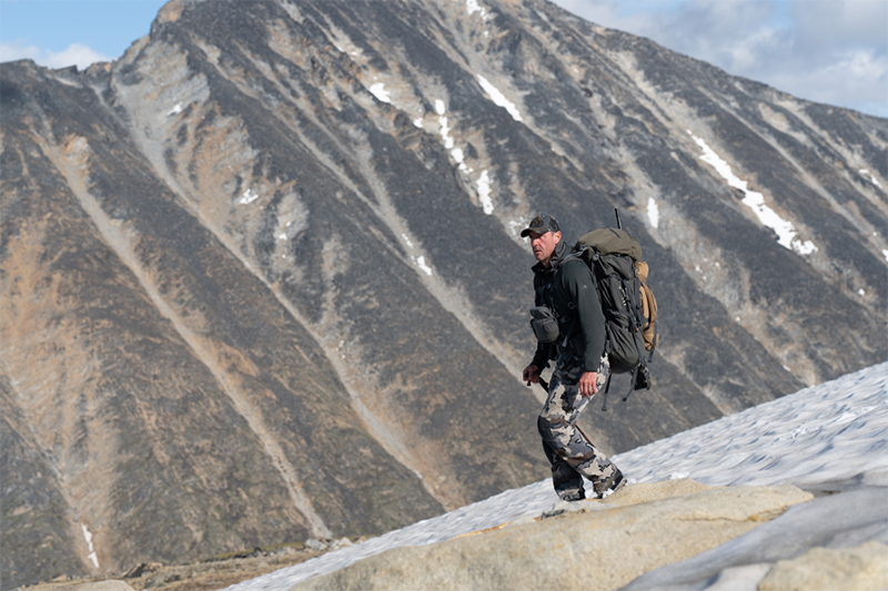
*Cotopaxi Fuego Hooded Jacket. This 800-fill down jacket provided warmth in the high mountains of Utah and Colorado. Cotopaxi.com
*Cooper AT3-XLT Tires. A quiet, smooth ride on the tarmac as well as a confident, stable ride when aired down to 22 psi on the Rim Rocker Trail. Us.coopertire.com
OutdoorX4 Magazine – Promoting responsible vehicle-based adventure travel and outdoors adventure