Trans-America Trail
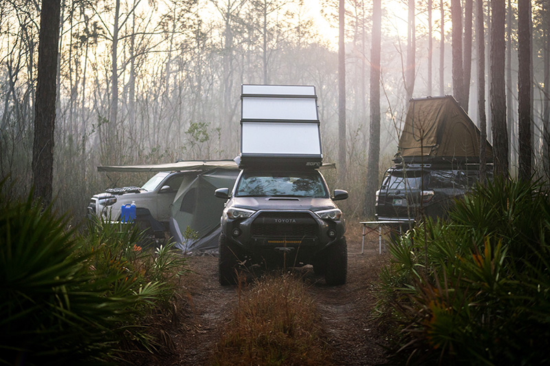
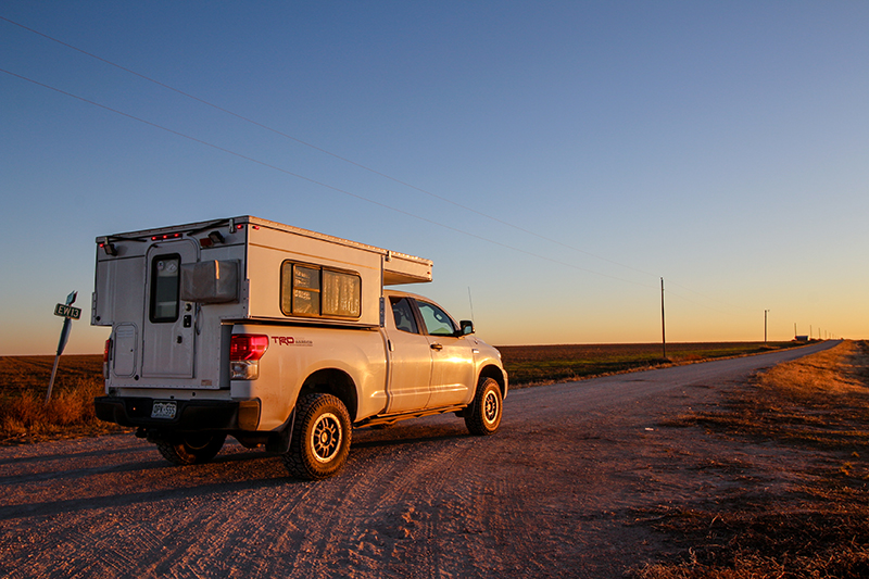
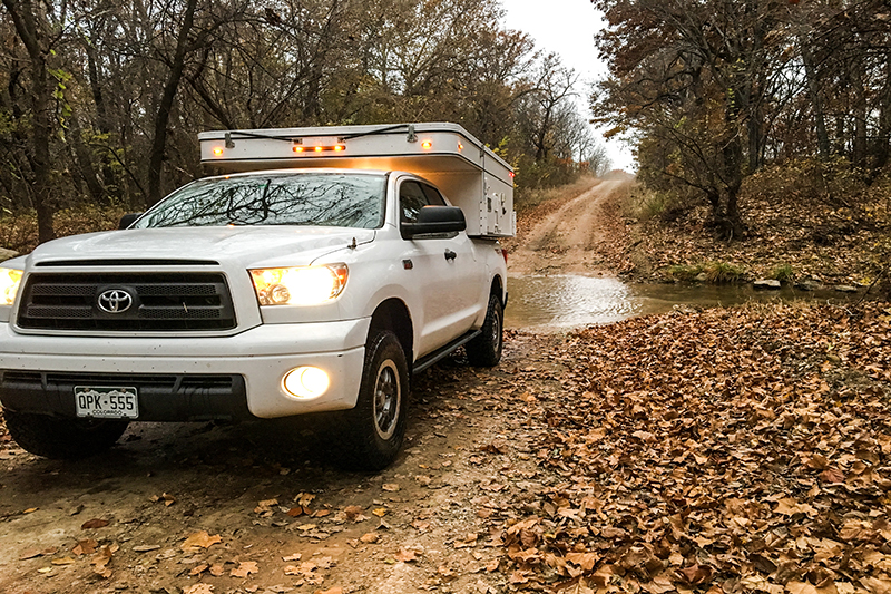
One week before opening day of deer season, I received an email inviting me to fill a hunting spot on my good friend’s private land. The spot was mine if I could squeeze in nearly 800 miles of travel from Denver, Colorado and arrive near Westville, Oklahoma in time for the hunt. With the email staring me down, I quickly mapped a route from Denver east/south-east to Westville. Highways and more highways…expedient but, not how I like to travel. With time ticking, my normal process of laying out a detailed backroad route would not work. Having previously explored 1,300+ miles of the Shadow of the Rockies trail through New Mexico and Colorado, I had found a solution; the Trans-America Trail (TAT). An order was placed for the trail map of the Oklahoma portion of the TAT and within minutes of receiving the coordinates I had the route loaded to the GPS. I requested the time off from work and from family, packed the Four Wheel Camper and was ready knowing I could make it to far eastern Oklahoma in time AND drive it mostly on dirt.

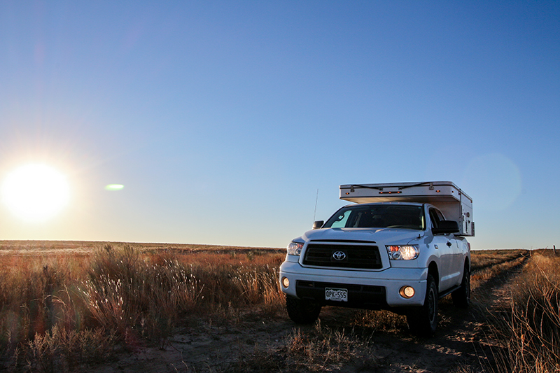
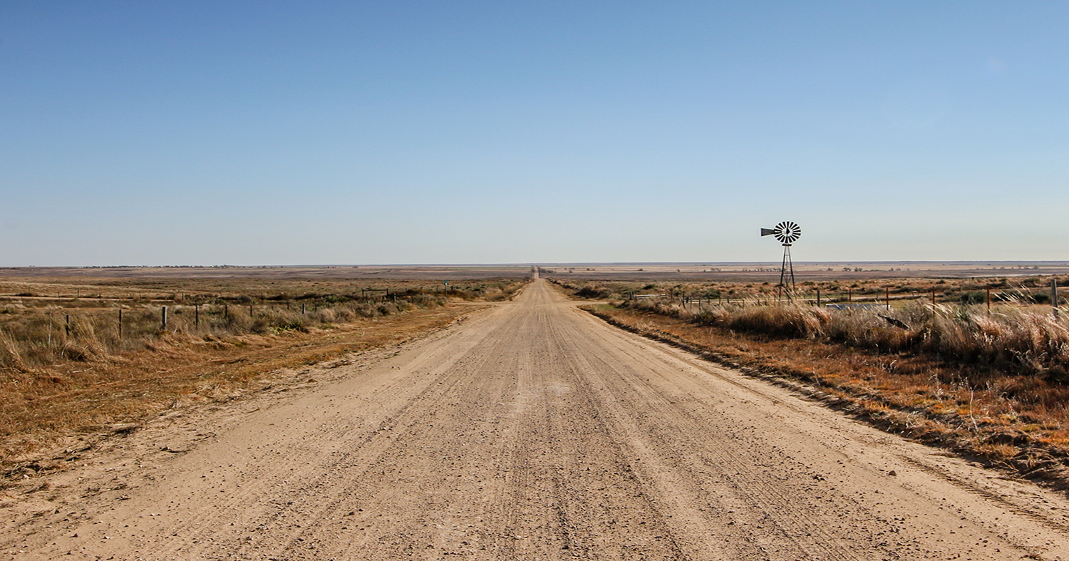
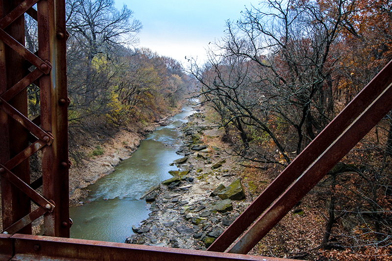
The Trans-America Trail, or TAT as it’s affectionately known, runs from North Carolina to Oregon and is well known in the adventure motorcycle community as being a bucket list ride. Sam Correro, the creator of the TAT, provides Maps and Roll Charts specifically designed for the trail to be navigated from East to West. He also provides GPS routes which can be reversed allowing me to run the trail in my 2013 Toyota Tundra and 2014 Hawk Four Wheel Camper, in the opposite direction, west to east. I began the trail along the New Mexico/Oklahoma border near Black Mesa State Park (36.841857, -102.882818) which is the highest point in the Oklahoma at 4,973 ft (1,516 m) above sea level. I’d love to tell you more about Black Mesa but the short days of fall had me arriving after sundown on Wednesday and leaving in the pre-dawn hours Thursday morning. With 673 miles of dirt roads to cover, I didn’t have the luxury of waiting for the warmth of the sun to compliment that first cup of coffee.
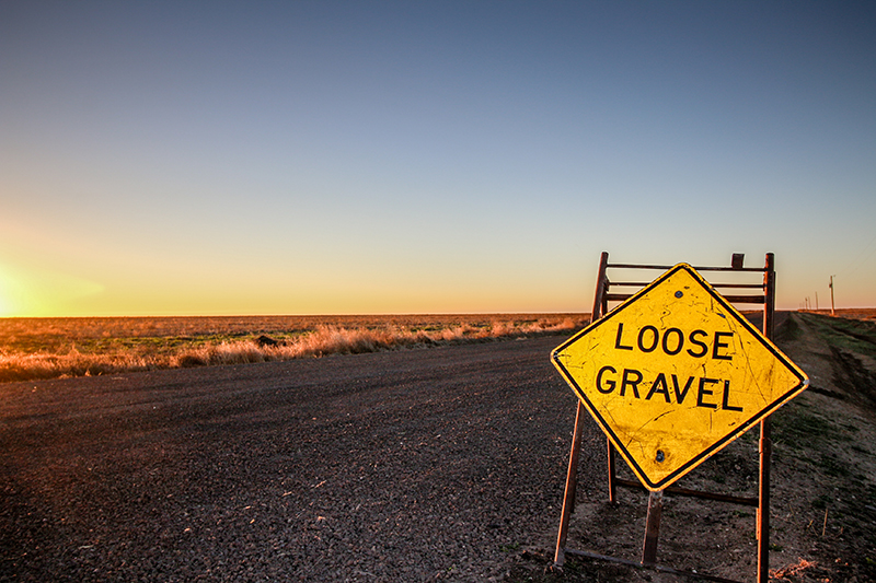
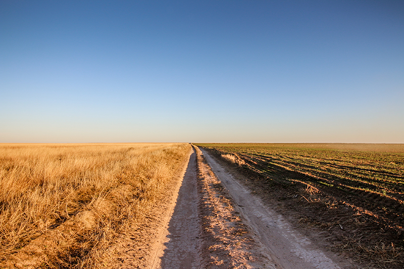
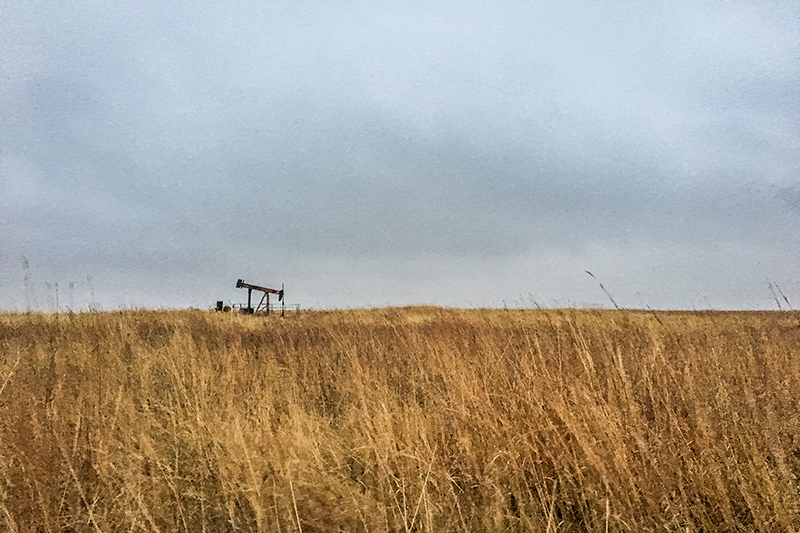
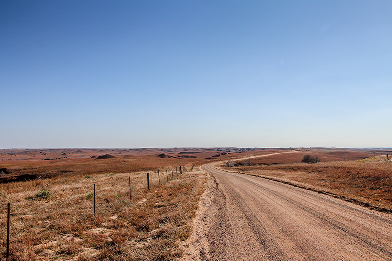
The Oklahoma portion of the TAT follows mostly gravel roads, surprisingly well graded I’m assuming for oil field trucks, not necessarily the motorcycle adventurers frequenting the trail. The roads are generally straightforward with not much in the way of obstacles. When wet however, sections of the route can be challenging or possibly impassable due to muddy conditions. It’s also easy to imagine that the many low water crossings in the central portion of the state can flood and may require a reroute.
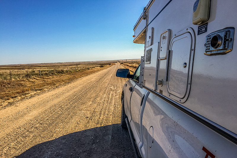

Roll charts for the TAT are available and would add its own fun and authenticity for those seeking an electronic free experience, but simply following the GPS tracks provided for an easier understanding of the route and allowed me to keep my eyes on the road. Heads up driving was necessary to catch the nuanced changes in the scenery as well as to watch for the occasional truck traffic or road blocks of the longhorn variety. Surprisingly, there is strong cell service most of the route allowing use of a basic iPhone GPS app which supplemented my Garmin eTrex unit borrowed off my dual-sport motorcycle. Cell service was also welcome when searching for alternative camping and fuel stops.
Many who ride/drive the TAT stay in motels and that is certainly an option. A little pre-planning and having the advantage of my Four Wheel Camper allowed me to utilize one of the relatively few public campgrounds in Oklahoma. Generally speaking, camping in Oklahoma is limited to state parks, Corps of Engineer lakes, and private RV campgrounds. Bear Creek Cove Campground (36.840069, -96.911146) is operated by the Corps of Engineers and is a little over halfway along the TAT and home for my second night.
The campground was clean and quiet and offers 22 sites with electric hookups, drinking water and nearby toilet facilities. Unlike Colorado and other western states, don’t count on dispersed camping since most land is privately owned and it’s unlikely trespassing would be looked kindly upon in these parts. Fuel stops did not require such high level of planning being as the TAT is designed with the dual-sport motorcycle in mind and limits the distance between fuel stops to an average of 60 miles. I found this to be true in Oklahoma and while some planned gas stations turned out to be permanently closed overall availability was never an issue.
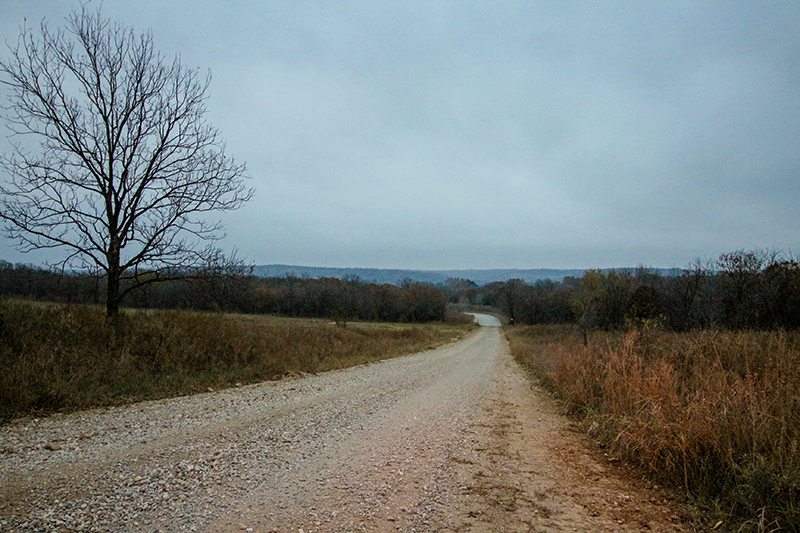
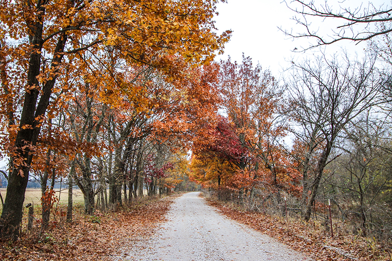
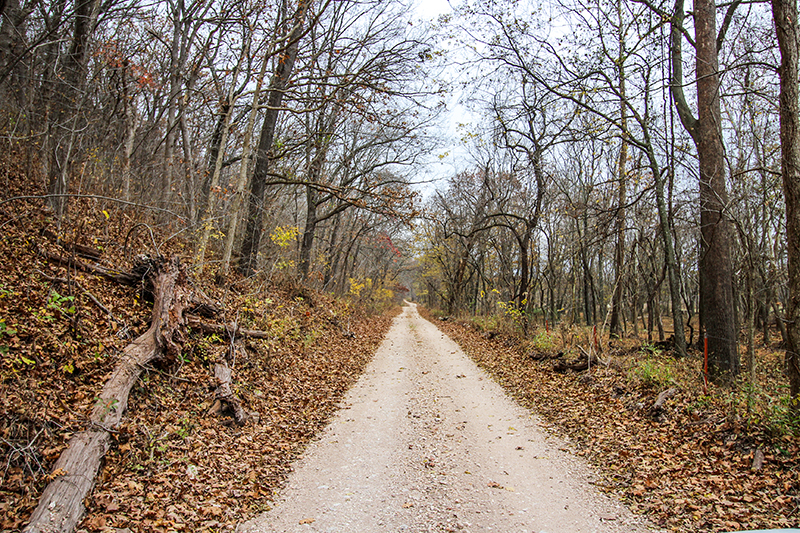
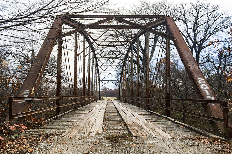
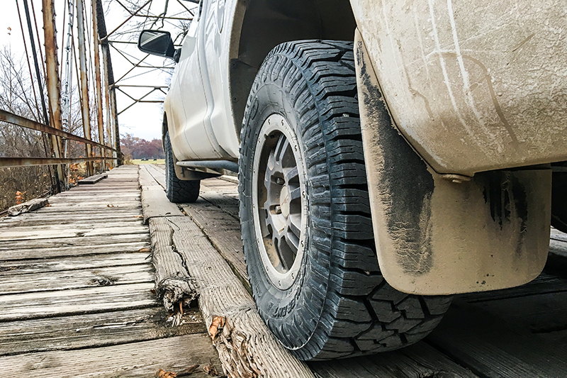
Friday morning found me heading east and transitioning from the wide open ranchland of western Oklahoma to the dense hardwood forest of the eastern portions of the state. Cruising with the windows down, by mid-morning a subtle whiff of the leaves of fall began to fill the truck replacing the smell of grass, soil, and agriculture. Following a second full day dusty roads, wood bridges, and the crunch of gravel under my tires I sadly departed the TAT to arrive just in time for a fantastic Friday evening steak dinner at the hunting camp.
The backroads of Oklahoma returns the traveler to a time of covered wagons and the land rush. These days the wagons and Sooners have been replaced by oil field trucks and aging homesteads, many in various stages of decay while others still operated by the same family over decades. Oklahoma might not offer the makings of overlanding lore but it does provide adventure if you seek it out.
To learn more about the Trans-America Trail I encourage you to visit Sam Correro’s website at www.transamtrail.com. There he details the entire 5,000+ mile cross country route with maps, roll charts and/or GPS tracks for each individual state or the whole trail.
* OutdoorX4 Magazine – Promoting responsible 4×4 adventure travel and outdoor recreation