Traveling the Fundy Shore
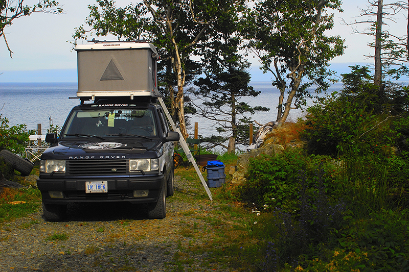
Around 1:00 am we heard a noise. It was strange, yet familiar. As I slowly awoke, I realized it was whales in the Atlantic Ocean, 300 feet below our cliff-edge campsite. As we drifted in and out of sleep, the whales continued to serenade us until the sun came up in the morning. It was a great way to begin our Fundy trip.
I received a call the day before we were to leave from a friend who was renting a cottage on White Head Island with his family. One of the two ferries was down with mechanical issues. If we didn’t reach the dock in Blacks Harbour by 7:00 am, we’d be waiting at least four hours for the ferry to return to the mainland. We decided to depart a bit earlier and drive straight to the ferry. As we drove through the moonless night down two-lane blacktop in the middle of New Brunswick, I watched the road; my wife watched the shoulders for eyes reflecting back. Moose — not something you want to run into. All went well and with five minutes to spare, we pulled into the dock and boarded the ferry to Grand Manan Island.
Fundy Shore
The Bay of Fundy is one of the Seven Natural Wonders of North America. Featuring the highest tides on earth, the rarest whales in the world, semi-precious minerals and dinosaur fossils, it really is a unique location. The bay is bordered by New Brunswick on the north and Nova Scotia to the south. Our trip took us along the northern shore, from Blacks Harbour and Grand Manan Island eastward to Hopewell Cape.
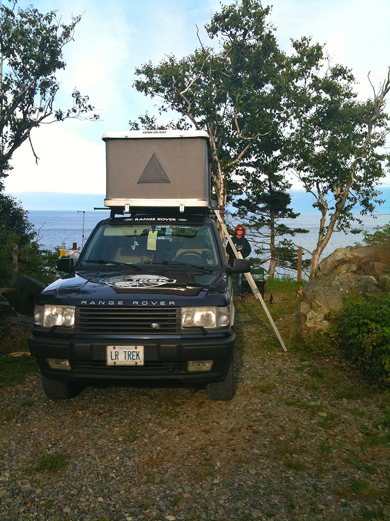
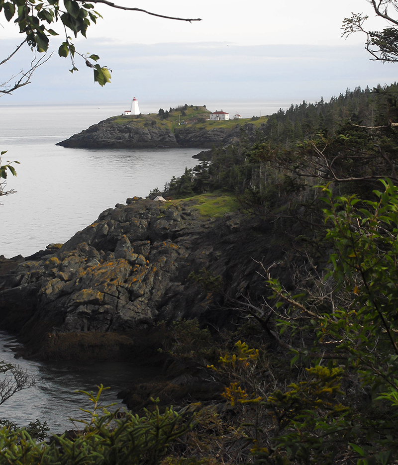
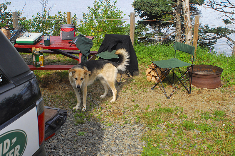
Grand Manan Island is a birder’s paradise. The main road runs north to south along the eastern side of the island. While there are a couple of provincial park campgrounds, we had booked into the Hole in the Wall Campground, just north of the ferry terminal. Campsites are offered right on the cliff edge and we parked the Range Rover about ten feet from the 300-foot drop and opened our rooftop tent. The scenery was spectacular. There are numerous hiking trails on the island but there are trails directly accessible by foot from the campground up to Northern Head.
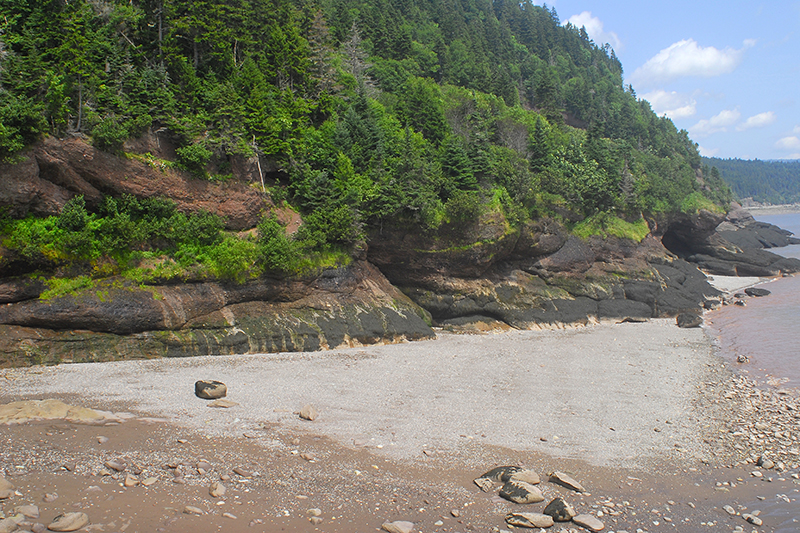
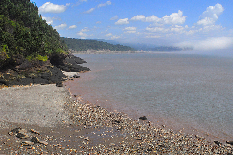
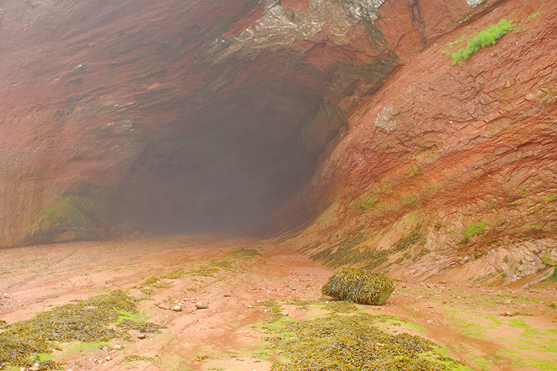
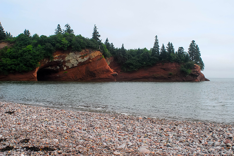
Leaving Grand Manan Island we headed toward Saint John and found an interesting campground accessible only by ferry to spend the evening. We camped well away from the country music jamboree that was taking place that night. The following day we were to meet a couple we had connected with online to run some trails in the area. The day turned out to be a lot of fun and we ended up at St Martins with the tide in. There are some great rock formations and sea caves here and the following morning with the tide out, we were able to walk out on the ocean floor and explore them. Some of these caves are capable of parking two or three semi-trucks and trailers inside.
Just east of St Martins is the Fundy Trail Parkway, a 19-kilometer (12-mile) road along the coast with hiking trails, look-outs and a dog-friendly interpretive center. It was a very foggy day as we hiked a few trails, checked out waterfalls and toured the visitor center before heading to Fundy National Park. Fownes Head Trail takes hikers to Flower Pot Rock (quite fogged in the day we visited) and Fuller Falls, where there are great views of the falls, both from the top and at the base if you are willing to use the cable ladder to get up and down.
Fundy National Park, at 207 square kilometers, features 7.5 miles (12 kilometers) of dramatic, rugged shoreline. The park features two main campgrounds, Chignecto North at the northwest entrance to the park, and Point Wolfe, down along the Fundy shore. There are over 75 miles (120 kilometers) of hiking trails, forest drives and mountain biking on specific trails.
The Fundy Footpath links the park with the Fundy Trail Parkway. This challenging 24-mile (41-kilometer wilderness trail takes between three and four days to hike. The terrain moves up and down between 0 and 300 meters elevation as it crosses numerous ravines.
Our hikes in the park included a forested section of the Fundy Footpath from the Point Wolfe campground; Matthews Head, which follows fields through a second-growth forest to the top of rugged cliffs overlooking the Bay of Fundy, where on a clear day you can see Nova Scotia; and hiking the ocean floor while the tide was out. With all the trails, a week could be spent hiking these Acadian forests.
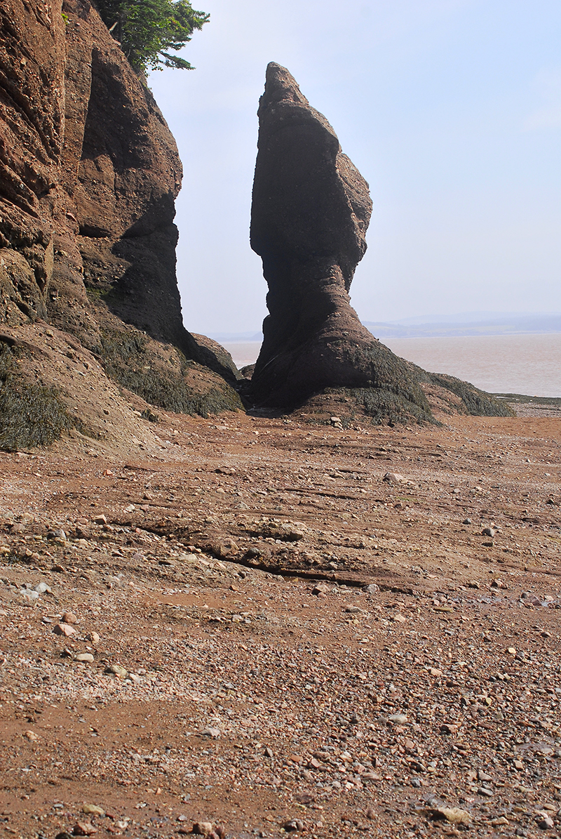
The final destination for our week along the Fundy Shore was Hopewell Rocks. The tides here reach 50 feet and visitors can walk the ocean floor to view the sea-carved flower pot rocks at low tide and come back six hours later to see the rocks completely surrounded by water. Once again, dogs are welcome, and while I thought I’d have to carry our dog down the open grate stairs to the sea floor, she proved me wrong and went straight down on her own. After a morning exploring these rock formations, it was time to start for home.
The trip home was uneventful and we took the opportunity to spend an afternoon in old Quebec City en route, with a final evening camped along the St Laurence River shore.
Planning to visit:
Fundy National Park: http://www.pc.gc.ca/eng/pn-np/nb/fundy/index.aspx
Fundy Trail Parkway: http://www.fundytrailparkway.com/en/
Grand Manan Island: http://grandmanancamping.com/
The New Brunswick Backroad Mapbook features all the on- and off-road trails as well as information on parks, trails, natural attractions and more.
And, as you travel through Alma, plan to stop at Kelly’s Bake Shop on the main street for some of the best sticky buns you’ll ever enjoy.
* OutdoorX4 Magazine – Promoting responsible 4×4 adventure travel and outdoor recreation