Lake Superior Provincial Park
There’s a common saying along Lake Superior, “if you don’t like the weather, wait ten minutes”. Indeed, one minute you could be pelted by rain, as the wind howls and Superior thunders against the shore but in a short period of time, the clouds part, the sun comes out, the wind subsides and Superior is as calm as, well, Superior can be.
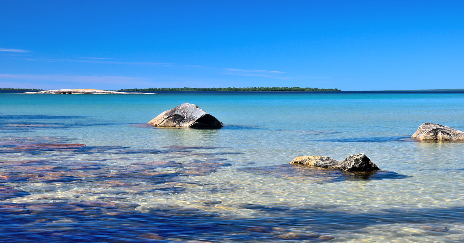
Lake Superior
is the world’s largest fresh water lake. At 31,700 square miles (82,170 square kilometers), it is bigger than Vermont, Massachusetts, Rhode Island, Connecticut and New Hampshire combined and at the deepest point 1,300 feet (400 metres) below the surface. This sheer size means it contains 10% of all the earth’s fresh surface water.
It’s a long drive around Lake Superior, over 1300 miles (2,100 kilometres), a trip we made last summer. But, as we were leaving Pukaskwa National Park in Northeastern Ontario, near the end of our trip, we received some news from home and cut our trip short. The last couple of days were to be spent in Lake Superior Provincial Park. As we drove along Highway 17 through the park, we realized we needed to return and explore it further. In reality, the day and a half we had allocated would never have been enough to fully discover all the park had to offer.
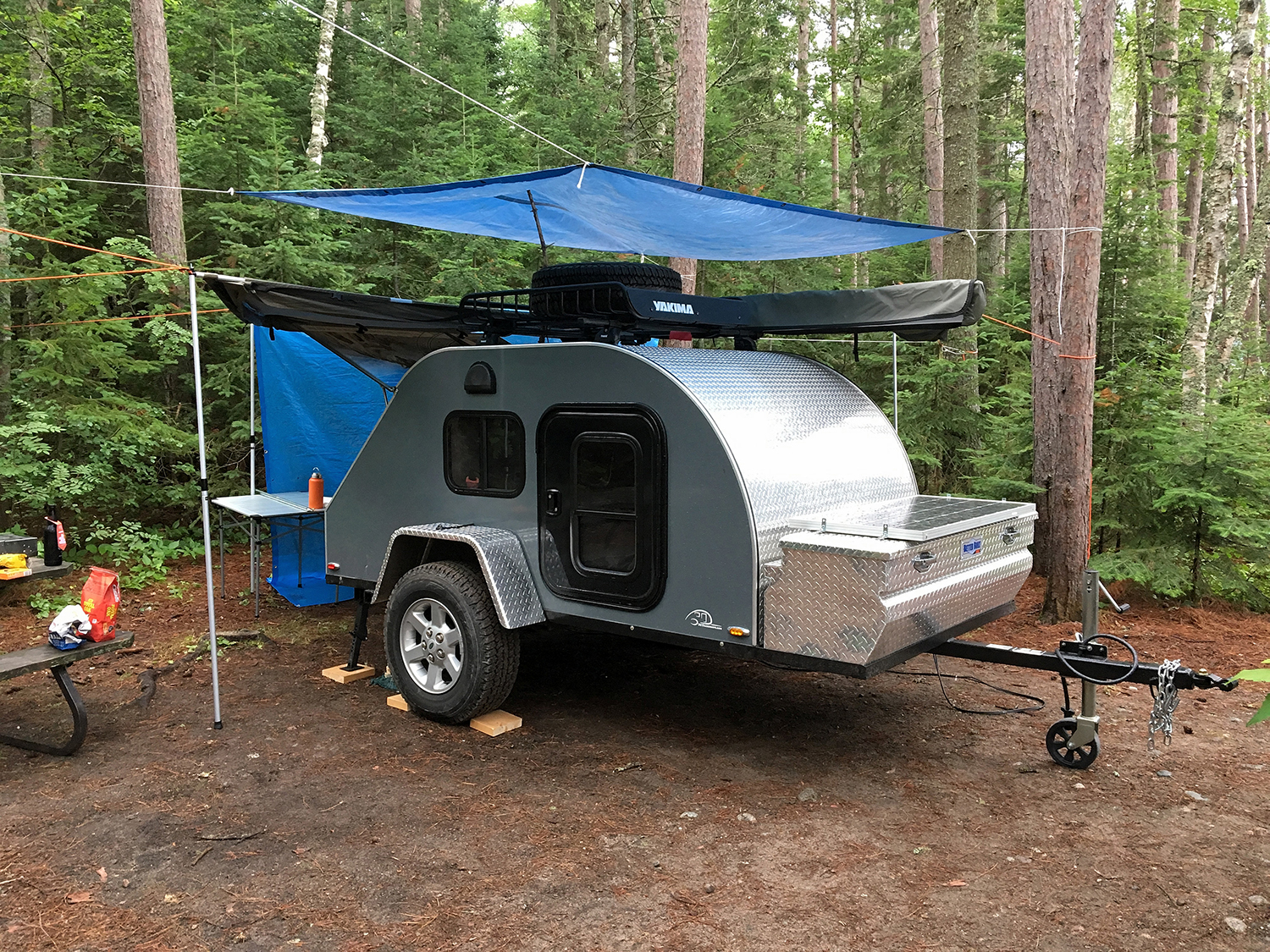
And Lake Superior Provincial Park has a lot to offer. Along the 52 mile (83 kilometre) stretch of Highway 17 that runs through the park, there are two campgrounds, three picnic areas, eleven hiking trails, eight canoe routes and over two hundred backcountry campsites. We booked a week in the Agawa Bay campground near the south end of the park which would become our basecamp for the week. It was also a chance to try out our new TCTeardrops off road trailer.
This great open space gives force to the winds, and they stir it up with as much violence as the Ocean. Jesuit Relations, 1669-71
We started out on what appeared to be a sunny Sunday morning for the ten hour drive from our home to the park. Around Sudbury, the clouds rolled in and we drove through constantly changing rain, light to heavy downpour. The wet weather started to recede as we arrived at our campsite, less than one hundred feet from the shore of Lake Superior. A cold craft beer and a steak grilled on our Esbit bbq completed a long day.
Monday we headed to the Visitor Centre, located at the campground entrance. It offered a great history of the park, the lake, early activities including fishing and logging and a really unique push railway handcar known as a velocipede. As northern Ontario was slowly being opened to visitors, it caught the attention of the Group of Seven, artists from the Toronto area. Between 1918 and 1922 they moved up each spring and stayed to the fall, living in a rented railway boxcar and painting the landscape they discovered. The handcar and a canoe allowed them to reach areas of the park where roads had yet to be completed. Their bold style and vibrant colours were originally criticized but the paintings they created in this area helped define a distinctly Canadian art.
“We discovered a paradise for Canadian painters – wild, rugged, tumultuous country … “
Lawren Harris –Group of Seven
After our history lesson, we began our exploration of the park. Our first stop was the Agawa Rock Pictographs. The short trail travels through broken boulders and huge rock chasms leading to the shore of the lake. In good weather, visitors can walk out on a narrow, tilting ledge at this sacred site and view red ochre paintings representing the dreams and spirits of the Ojibwe.
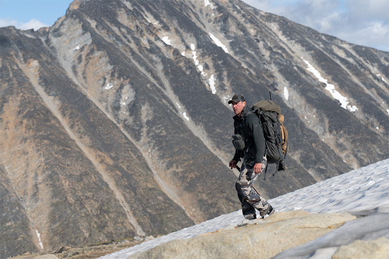
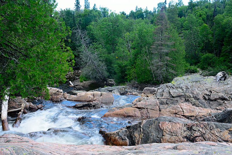
While there are a number of hiking trails right off the highway, a destination for many hikers is the 40 mile (65 kilometre) Coastal Trail, a rugged and demanding hike along high cliffs and rocky beaches. One of the great features of the trail is it can be accessed from numerous spots in the park. We had decided to check out the northern section and the LR3 received its first workout of the trip as we took fifty minutes to drive down the 8.7 mile (14 kilometre) Gargantua Road to the trailhead access point. The roads are not overly maintained likely in an effort to keep vehicle speeds down due to the wildlife. From here, we hiked about 6.25 miles (10 kilometres), towards Warp Bay discovering the first of many great waterfalls located in the park.
Over the following four days we hiked a couple of the trails every day. Each trail offers a different unique perspective into the geology of the area. The Nokomis Trail features sections of river rock along the trail. It seemed out of place but the area was formerly a seabed and the rocks stayed in place as the water receded. Trappers Trail, though short, shows a glimpse of the marshy wetlands often frequented by moose. The Pinguisibi Trail offers up waterfall after waterfall on its 3.75 mile (6 kilometre) out and back.
Our favorite of the entire week was the 5 mile (8 kilometre) Orphan Lake Trail. It featured a bit of everything; forest, including a section of a burn area, rocky Superior shoreline and what we considered was the best waterfalls/rapids we had seen in the entire park on the Baldhead River. Like the Nokomis Trail, it also offered spectacular lookouts over the lake as you climbed higher.
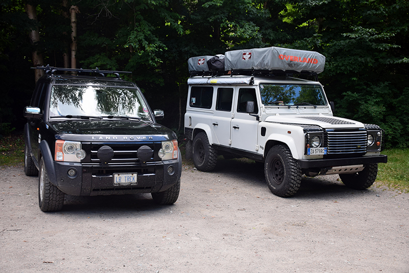
It was also on the day we hiked Orphan Lake that we ran into a family of five from Denmark. As I was photographing the Lake at Katherine Cove, a white Defender passed by. The family had brought their 110 TD5 over from Denmark and it was well packed with two Autohome tents on top.
We enjoyed a guided walk our last night at camp. Because the park runs such a long distance from south to north, even the trees change with maple, birch, pine, spruce and cedar, some as a result of new growth after fires. In some sections along the shore, due to moisture off the lake, the forests take on a rainforest feel, the only other place in Canada this can be seen except for British Columbia.
Too soon our week was up and it was time to head home. The park was great, the sunsets amazing, the water refreshing, but cold and everyone in the campground respected the quiet. At night, as you sat around the campfire, all you heard were the waves washing up along the shore.

Northern Ontario is a vast open space and Lake Superior Provincial Park is just a small area. The Chapleau Crown Game Preserve, just northeast of the park, offers the largest concentration of black bears in the province. After travelling around Superior last year and spending another week up north this year, we’ve grown to love this area of our province. There is much more to see and many more adventures ahead.
Editor Note: Interested in exploring the park or northern Ontario? Ontario Parks (www.ontarioparks.com/park/lakesuperior) and the Friends of Lake Superior Provincial Parks (www.lakesuperiorpark.ca) websites offer lots of information on the park. The Northwestern Ontario and Northeastern Ontario editions of the Backroad Mapbooks (www.backroadmapbooks.com) feature maps and detailed information on fishing, hiking, trails, parks, paddling routes, attractions and more.
* OutdoorX4 Magazine – Promoting responsible 4×4 adventure travel and outdoor recreation