
onX Expands Disbursed Camping Coverage
June 15, 2026
Just in time for peak overland travel season, onX, the leader in outdoor digital navigation, today announced a major expansion of its Dispersed Camping Layer, giving vehicle-based adventurers unprecedented access to legal camping opportunities across America’s public lands. The update extends coverage from mapping 166,638 miles of Forest Service roads to now include 193,079,484 acres of Bureau of Land Management (BLM) land.
![]()
As overlanding, vehicle-based exploration, and self-supported adventure travel continue to surge in popularity, travelers are increasingly seeking multi-day routes that combine off-road access, remote campsites, and flexible trip planning. Yet one of the most persistent challenges facing overlanders and dispersed campers remains identifying where overnight camping is legally permitted along a route.
Historically, answering the question “Where can I camp tonight?” has required navigating a maze of agency websites, Motor Vehicle Use Maps, closure notices, forum discussions, and local knowledge. The result is often uncertainty in the field, forcing travelers to guess whether they are camping legally, safely, or sustainably.
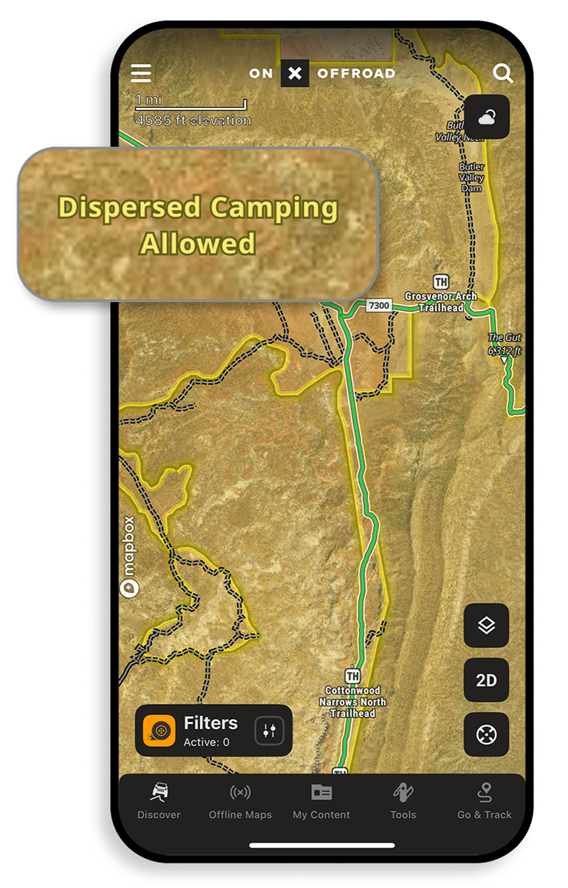
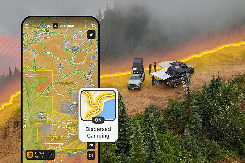
By integrating dispersed camping information directly into the navigation experience, onX helps overlanders, off-road enthusiasts, truck campers, van travelers, and adventure motorcyclists confidently plan routes and identify camping opportunities along vehicle-accessible roads and trails.
“Dispersed camping is a core part of the vehicle-based adventure experience but figuring out where it’s actually legal has always been a major challenge,” said onX Offroad Content Manager Chris Cordes. “We worked directly with federal land management agencies to create a solution that brings clarity at scale across 40 states and hundreds of millions of acres. The layer shows where camping is allowed—and just as importantly, where it isn’t. That helps distribute recreation across a broader landscape, reduces pressure on heavily trafficked campsites, and gives travelers better opportunities to discover the solitude and freedom they’re seeking.”
The expanded coverage creates significant new opportunities for route planning across some of North America’s premier overland destinations. Nevada and Alaska each contribute more than 40 million acres of mapped BLM land, while Utah adds more than 18 million acres and Wyoming more than 16 million. On Forest Service lands, California leads with more than 30,000 miles of mapped dispersed camping corridors, followed by Idaho (21,774 miles), Oregon (20,978 miles), and Montana (15,506 miles).
The update also strengthens vehicle-based camping access across emerging overland regions in the Midwest and East, including more than 4,200 miles of Forest Service corridors in Michigan and nearly 2,000 miles in Wisconsin. These regions have traditionally been more difficult for travelers to navigate when searching for dispersed camping opportunities, making reliable access information especially valuable for trip planning.
As demand for overland travel, remote camping, and self-guided outdoor adventures continues to grow, the expanded Dispersed Camping Layer gives adventurers the confidence to explore farther while helping land managers encourage responsible recreation across public lands.
For more information about the Dispersed Camping Layer and how to use the feature with onX Offroad, visit the onX Offroad website. onX Backcountry users can also learn more about camping and trip-planning features through the onX Backcountry platform.
Editor Note: You can get four months of onX Offroad Elite for FREE when you subscribe to OutdoorX4 Magazine in print and/or digital. Sign-up HERE to subscribe to OutdoorX4. To learn more about the disbursed camping layer within onX Offroad, click (or tap if on mobile) the link HERE.
OutdoorX4 – Promoting responsible vehicle-based adventure travel and outdoors adventure