Exploring the Wyoming Backcountry
Wyoming is known for its beauty, wide open spaces and rich history, with an endless supply of campfire tales about famous outlaws and frontiersmen — Butch Cassidy, the Sundance Kid and their Wild Bunch Gang, Wild Bill Cody, Red Cloud, Crazy Horse are all a part of the stories of these plains. Wyoming also has bragging rights to some impressive landmarks. Becoming the 44th state in 1890, it is home to this country’s first national park (Yellowstone) and our first national monument, Devils Tower. If those two tourist attractions aren’t enough, Wyoming was also the first state to allow women to vote and the first to elect a female Governor.

Our group took a couple of weeks this past summer to visit some of the places that tell the story of Wyoming, exploring routes emigrants took more than 100 years ago in search of new beginnings. In our travels we wanted to retrace the routes the outlaws traveled and hear stories of the Indian tribes and the harsh environments that make up the state that is still home to only half a million people. It is the least populated state in the union and those who live there are a hardy group of people who appreciate the outdoors, history and a sense of freedom.
Our trip began in Casper, the state’s second largest city. To some it seems small but it can seem like a metropolis when you’re from Wyoming. Since we planned to circumnavigate the state, it seemed as good a place as any to begin.

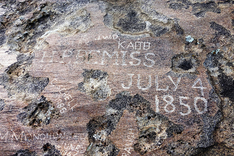
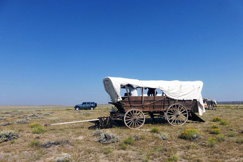
We headed out in the early morning while the air was still cool, pointed the Jeep in a southwesterly direction, and headed down the back roads to our first stop at Independence Rock. A state historic site, Independence Rock was a location on the Oregon Trail that travelers knew they must reach by July 4th in order to avoid suffering the same fate that the infamous Donner party, who resorted to cannibalism, did in Northern California. The giant granite rock is easily visible from one of the state’s main highways, but those who don’t know its meaning could drive right by without a clue to its historic value. This is much more than just a stop where many pioneers and emigrants took time to climb the rock and carve their names into the surface; it is the last place some of them would make their mark.
A mile or so down the road from the famed rock is a small grave on an old highway at Devil’s Gate. Devil’s Gate and the story of Martin’s Cove is another that is unique to the area and I will leave you to research and learn the story for yourself. The grave is that of Frederick Fulkerson, who died trying to ford the nearby river to get his family’s livestock across the swift waters; it is still among the oldest known emigrant graves on the Oregon Trail and is a testament to the daily challenges of those who sought a new life out west. After a few minutes there we turned the Jeep around and made our way to the eastern side of the state.

We traveled across the open plains for close to three hours toward the small town of Guernsey, where we checked out some of the actual Oregon Trail ruts still visible today. These ruts are carved deep into the rock, long outlasting those who actually traveled the Trail. A short jaunt through town put us in front of what could easily, from a distance, be dismissed as just another wall of dirt in the vast open plains, until you get up close to look at Register Cliffs. Upon further inspection the names of wagon masters and emigrants take shape by the hundreds and then thousands to impress upon the viewer how many people actually stopped here to catalog themselves as some who survived the trip this far west. It was a short time before we looked at one another with wonder and the question, “How many of these people didn’t make it to Independence Rock?”
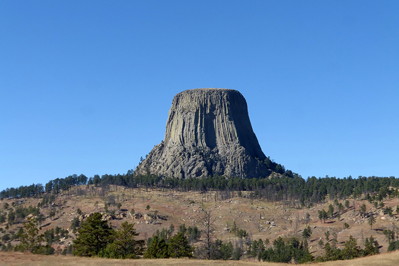
Devil’s Tower
The next leg of our journey took us to the northeastern corner of the state to America’s first national monument and the last place you would expect to see a monolithic rock standing high above the landscape. Devil’s Tower is the subject of Indian legend, movie sets and simply a thing of wonder: How could this giant formation have been created and still stand as it does among the rolling hills and open plains? We spent a couple of hours walking around the base of the tower, reading the placards about its creation and legends before we were once again on our way, seeking a suitable location to camp in the middle of the state, this time in the Big Horn Mountains.
We headed west on I-90 to make up some time so we could set up camp and build a fire before the sun went down. We stopped in Buffalo, a small town with about as much history as the state does as a whole. In the 1800s, the local Occidental Hotel (which still stands today) saw the likes of Teddy Roosevelt, Butch Cassidy and many other recognizable names from the days of the true “Wild West.” As we made our way south and closer to Crazy Woman Canyon, we found ourselves in the middle of the area where the infamous Johnson County Cattle War took place. We could easily have spent a whole day in Buffalo just milling around and seeking out stories of the “good old days,” but under the time constraints, we pushed on toward Crazy Woman Canyon and up the east side of the Big Horn Mountains.

After another long day of travel and sightseeing it was great to sit around a campfire, reflecting on the sights we’d seen and discussing how convenient life is during these modern times by comparison. We enjoyed a gourmet dinner, compliments of our friends at Mountain House and Jet Boil, knowing it was time to settle into the tent and get some rest. Tomorrow would be a whole new adventure!
There’s something unnerving about being thrust awake at 1:30 a.m. by the sound of wolves howling, most likely celebrating a fresh kill. It has been speculated that the wolves reintroduced into western Wyoming and Montana have migrated toward the Big Horns and, after this night, there need be no more speculation! There were at least three and they sounded as if they were no more than 100 yards away from our camp. No bonfire, no locked doors, no 911 to call, just the dark and the sheer fabric of the Coleman tent separated us from the thing that livestock and ranchers in this state fear the most.

From then on our sleep was interrupted by every sound in the forest; a limb would crack in a tree, the leaves on the ground would rustle, all of our senses were heightened and our minds were on high alert. After a very restless night, we had a small breakfast, broke camp and loaded up to continue west.
As we headed down the western slope of the Big Horns, we dropped into the town of Tensleep, which acquired its name from the Native Americans since the town is “Ten Sleeps” from several areas on their migration routes. A quick stop for fuel and we were on our way to the west central part of the state and into the Wind River Mountains.

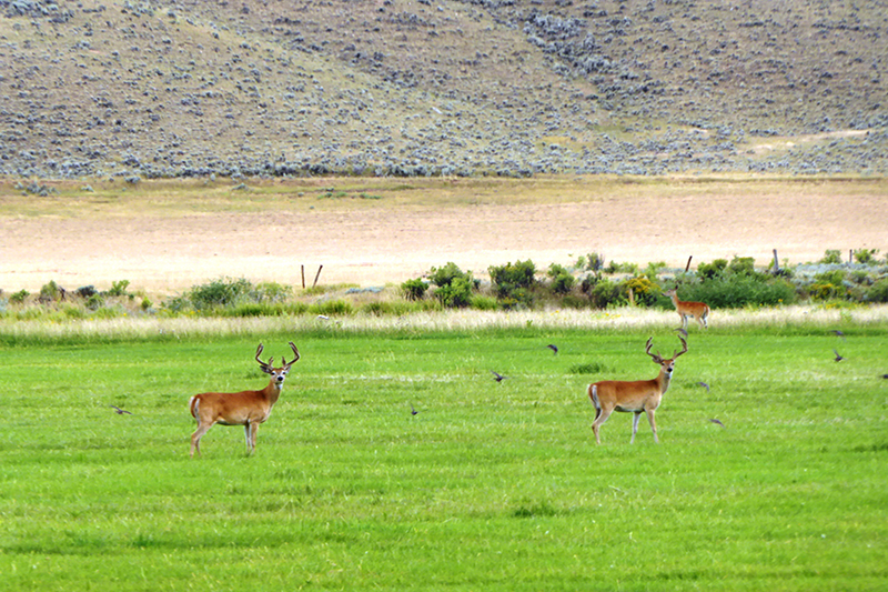
Our next stop was the town of Thermopolis, home to the world’s largest mineral hot springs. We took advantage of the healing pools and spent a couple of hours soaking and getting ourselves recharged for the next leg of our journey. Like Buffalo, Thermopolis is filled with things to do and plenty of wildlife to appreciate.
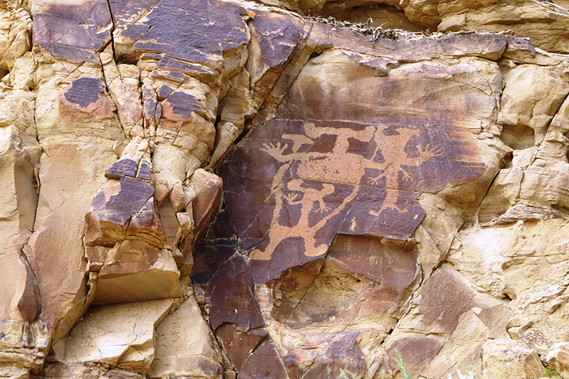
About 20 miles outside of Thermopolis is a petroglyph site dating back thousands of years. After a short hike and an hour or so spent examining the site, we headed back to the Jeep to make our way toward the restored ghost town of South Pass City to explore the resurrected town and mine site. Walking the streets of a town that stands as it did more than 100 years earlier and a couple of hours touring the mine sure make a person appreciate our modern conveniences! Next we were off to see something we had been waiting for… more of the Oregon Trail and the “Parting of the Ways.”

In another example of Wyoming’s secret ways of keeping amazing treasures hidden, only to be found by those willing to do the research, a couple of monuments stand alongside the aforementioned “Parting of the Ways,” where early settlers who had traveled long and far together would say goodbye to friends and sometimes family members as they went their separate ways on the Mormon, Oregon and California trails. To find this amazing location one must know exactly where to leave the paved road and how far to travel down a slightly maintained dirt road, before turning onto the correct two-track that will take you to the monuments and other historic markers.
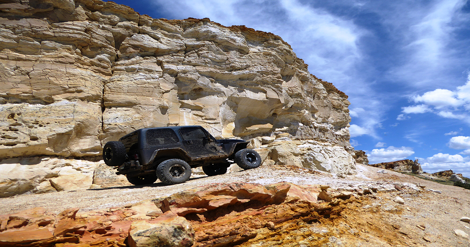
The next leg of this journey would be an adventure into the depths of the Wind River Mountain Range, one we didn’t want to take alone due to the difficulty of the terrain and the remoteness. We decided to call a few friends and make a wheeling weekend of it.

As we wrapped up our Wyoming adventure and made our way back to where we started, completing our statewide circle, we wanted to add one more stop. The Castle Gardens petroglyph site in central Wyoming is another reminder of how marks on a sandstone wall, a name carved in granite, or wagon ruts can far outlast our time on this earth and how important each day is. As I reflect back on my adventures in Wyoming, I can only encourage readers to get out and make their metaphorical mark on the world. If you’re the type of adventurer who wants to see and learn more about what made the West “Wild,” consider making your way to Wyoming and spending a few days checking out the sights and talking to the locals. You may be surprised at what you learn. Until next time, life is but an adventure… get out there and live it!
* OutdoorX4 Magazine – Promoting responsible 4×4 adventure travel and outdoor recreation